Backpack-in or horseback-ride-in environmental camp, open first come, first served. Chemical toilets, non-potable water, corrals and tent sites.
Other permits in Cuyamaca Rancho State Park we can check
“A hike-in or ride-in environmental camp 4.5 miles from Green Valley, with chemical toilets, non-potable water and horse corrals, and no reservation system.”
Plan your Cuyamaca Rancho State Park trip here, then get your permit from the agency.
Walk-up permit
How to get Granite Springs
Granite Springs is issued by the agency rather than through a booking calendar. Their page has the current process and any dates.
Official permit pagePlanning another trip? See the permits we alert on.
Granite Springs permit season
- route distance, out and back
- 4.5mi
- max group size
- 8people
How to get a Granite Springs permit
No reservation. You get the permit when you arrive.
Arrive in person
Green Valley campground or Paso Picacho.
Fill in the permit
Register at park headquarters, the Paso Picacho contact station, or the Green Valley campground before using the trail camp.
Head out
1 to 7 nights is typical.
Cuyamaca trailheads and parking
- Green Valley campground
4,000 ft
- Paso Picacho
The two Cuyamaca trailheads in full
Primary4,000 ft elevation
Green Valley campgroundThe closest trailhead at 4,000 feet, 4.5 miles from Granite Springs, and one of three places you can register for the trail camp.
- Restrooms
Parking
Day use fee $10 per vehicle. Register at park headquarters, the Paso Picacho contact station, or the Green Valley campground.
Getting there
East of San Diego, the park is on Highway 79, five miles north of I-8, about 50 miles east of San Diego and 15 miles south of Julian. Day-use hours 8 AM to sunset.
Nearest services
Julian, 15 miles north.
Alternate
Paso PicachoThe higher trailhead at 5,000 feet, 7.5 miles from Granite Springs, and a registration point.
- Restrooms
Parking
Day use fee $10 per vehicle. Register at the Paso Picacho contact station.
Getting there
Five miles north of Green Valley on Highway 79.
Nearest services
Julian.
As of September 2026, Granite Springs in Cuyamaca Rancho State Park, California requires a permit issued via walk-up. Granite Springs rates 6/10 on PermitSnag's demand index. The Granite Springs route covers 4.5 miles, rated moderate.
- Type
- Overnight
- Location
- Peninsular Ranges, CA
How this permit is issued
Get this permit in person at the trailhead or ranger station, or by phone.
Official permit page →Step 1: Check the agency page for the process
This permit is not sold online. Confirm where and when it is issued (and any fee) at California State Parks before your trip.
Step 2: Arrive early
Walk-up permits are issued first-come, first-served. Where the agency sets a daily quota, popular trailheads can run out on weekends and holidays.
Step 3: Have backup plans
Popular trailheads fill fast. Know alternate routes or dates.
More on Granite Springs: Live availability activity
The Granite Springs hike
- Distance
- 4.5 miles
- Route Type
- Out & Back
- Duration
- 1-7 nights
- Difficulty
- Moderate
- Low Point
- 4,000 ft
Granite Springs landmarks
- 1Green Valley campground
The nearest trailhead at 4,000 feet, 4.5 miles from Granite Springs, with a creek running through the middle of it.
- 2Granite Springs Trail Camp
Chemical toilets, non-potable water, corrals and tent sites.
- 3Cuyamaca Peak
The second highest point in San Diego County, a 3.5-mile hike up Lookout Fire Road with 360-degree views to the ocean, the desert, the Salton Sea and into Mexico.
- 4Stonewall Peak
A two-mile trail climbing from 4,800 to 5,700 feet, only moderately difficult due to many switchbacks.
- 5California Riding and Hiking Trail
Runs through the park; Los Vaqueros Group Horse Campground sits near it.
A hike-in or ride-in environmental camp 4.5 miles from Green Valley, with chemical toilets, non-potable water and horse corrals, and no reservation system.
About this permit
Granite Springs is one of Cuyamaca Rancho State Park's two environmental camps for backpackers and equestrians. Both Granite Springs and Arroyo Seco are open on first come, first serve, and both have chemical toilets, non-potable water, corrals and tent sites. Primitive horse trail camps are located at Granite Springs and Arroyo Seco, with family campsites for up to eight people and one group site holding up to 16.
The approach depends on where you start: 4.5 miles from Green Valley, 7.5 miles from Paso Picacho, 5.8 miles from the Sweetwater Turnout, or 7.2 miles by equestrian trail from Los Vaqueros.
To use the trail camp, register at park headquarters, the Paso Picacho contact station, or the Green Valley campground. The park's warning is worth heeding: primitive sites are in an unlighted, remote area, so check in early to set up camp well before dark. Horse corrals are available, but equestrians should pack in feed because grazing is not allowed.
Fire is not allowed anywhere except in the developed picnic areas and campgrounds, which excludes the environmental camps. For current fire restrictions, call the park.
The route
Granite Springs and Arroyo Seco environmental camps are open on first come, first serve. Both have chemical toilets, non-potable water, corrals and tent sites, with family campsites for up to eight people and one group site holding up to 16.
The park's own trail table gives the distances. To Granite Springs it is 4.5 miles from Green Valley and 7.5 miles from Paso Picacho, or 5.8 miles from the Sweetwater Turnout. By the equestrian trails it is 7.2 miles from Los Vaqueros. The agency attaches its own caveat that portions of trails may occasionally be closed or restricted.
To use the trail camp, register at park headquarters, the Paso Picacho contact station, or the Green Valley campground. The park notes that primitive sites are in an unlighted, remote area, so check in early to set up camp well before dark. Horse corrals are available, but equestrians should pack in feed because grazing is not allowed.
Why it matters
Cuyamaca's two environmental camps are first-come, first-serve with no reservation system, and they provide corrals for horses. They sit in a landscape still visibly rebuilding after the 2003 Cedar Fire burned 90% of the park.
The feeling
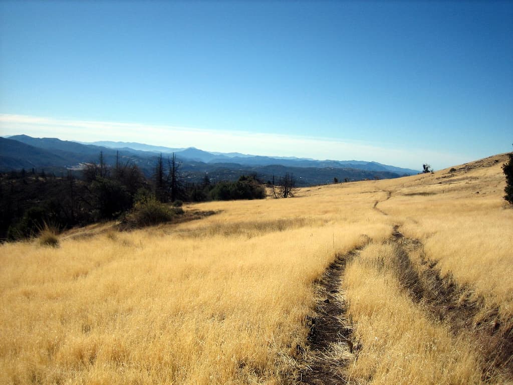
Oak and pine in San Diego's mountains, with standing dead timber from the fire still marking the ridgelines and young conifers coming up beneath.
Granite Springs hike highlights
- First come, first serve, with no reservation system at all
- Chemical toilets, non-potable water, corrals and tent sites
- Family sites for up to eight people, plus one group site for up to 16
- 4.5 miles from Green Valley or 7.5 from Paso Picacho
- A landscape still rebuilding from the 2003 Cedar Fire
- Registration required at headquarters, Paso Picacho or Green Valley before you go
How hard the Granite Springs hike is
- Physical DemandFitness and endurance required3/5
- Technical SkillClimbing, scrambling, or specialized skills1/5
- Exposure RiskSteep dropoffs and fall potential2/5
- NavigationRoute finding and trail clarity2/5
- CommitmentDifficulty of bailing out mid-route2/5
Best for: Backpackers and equestrians who want San Diego's mountains without a booking system, and horse parties who need corrals at the end of a ride.
Recommended experience: Water treatment and an early start. Register before you set out and reach the camp well before dark, as the park asks.
Not recommended for: Anyone who wants a guaranteed site. First-come means exactly that. Anyone hiking with a dog, and anyone wanting a campfire.
When to hike Granite Springs
Best time to visit
Spring and autumn. Spring brings green regrowth and running water in the drainages; autumn gives stable weather and cool nights. Summer carries the highest fire danger and the least shade, and winter here can be cold.
Weather Forecast
Trailhead (5,000 ft)
Today
85°
44°
Wed
88°
55°
Thu
88°
56°
Fri
89°
55°
Sat
92°
54°
Sun
90°
56°
Mon
90°
52°
Granite Springs photography guide
Golden Hour
Late light on standing fire-killed timber along the ridges, which is the defining feature of this landscape now.
Best Light
Spring, when the regenerating grasses and shrubs are green beneath the snags.
Beat the Crowds
First-come backcountry camps 4.5 miles in are rarely busy. The crowds are at Paso Picacho and Green Valley.
Classic Shots
- Fire-killed pines standing over young regrowth
- Oak woodland in the valleys below the burn line
- The 360-degree view from Cuyamaca Peak
- Horse corrals at a backcountry camp
- Mountain meadows in spring
Granite Springs rules, gear and safety
Gear checklist
Required- Water purification, or all your drinking water: the camp's water is non-potable
- Camp stove; fires are not allowed outside developed picnic areas and campgrounds
- Headlamp for an unlighted, remote camp
- Feed for any horses, since grazing is not allowed
- Warm layers for nights above 4,500 feet
Recommended gear
- A call for current fire restrictions before you leave
- Long sleeves and long pants for brush and ticks
- Sun protection for a burn scar with reduced canopy
- Extra water capacity in a dry range
- An early start, so you reach camp well before dark
Rules & regulations
- 01Granite Springs and Arroyo Seco Environmental camps are open on first come, first serve.
- 02Register at park headquarters, the Paso Picacho contact station, or the Green Valley campground before using the trail camp.
- 03Campsites are limited to 8 people maximum; one group site holds up to 16.
- 04Fire is not allowed anywhere except in the developed picnic areas and campgrounds. Wood gathering is prohibited in the park.
- 05Quiet hours are from 10:00 PM to 6:00 AM; visitors are not allowed between 10:00 PM and 6:00 AM.
- 06Check-in time is 2:00 PM and check-out time is 12:00 PM.
- 07Dogs must be attended and leashed at all times, and are restricted to the campgrounds, picnic areas, paved roads and the Cuyamaca Peak Fire Road.
- 08Equestrians should pack in feed because grazing is not allowed.
- 09Plan to arrive at your campsite before dark.
Hazards & considerations
- Non-potable water at the camp: treat everything.
- Fire is not allowed anywhere except in the developed picnic areas and campgrounds.
- Rattlesnakes are present in the park, along with mountain lions, bobcats and gray foxes.
- Standing fire-killed timber from the 2003 Cedar Fire, which burned 90% of the park.
- A remote, unlighted camp several miles from the nearest road.
- Summer heat and thin shade where the canopy burned.
Safety & planning
Emergency Info
Emergency contacts, ranger station locations, and satellite communicator tips for Granite Springs.
Food Storage
Bear canister requirements, approved container lists, and rental locations for this permit.
Gear Checklist: Required and recommended gear for Granite Springs · Shuttle Services: Trailhead transportation options · Guide Services: Experienced wilderness guides
Some links may be affiliate links. Purchases support PermitSnag at no extra cost to you.
Granite Springs FAQ
How do I get a Granite Springs permit?
Granite Springs is issued directly by the agency. It is issued in person or by phone, so there is no reservation to book and no cancellation to catch. Bring backup dates and check their page for the current process.
When is the best time to visit Granite Springs?
Season dates are on the agency's page. Weekdays have better availability than weekends.
How competitive is the Granite Springs permit?
This permit has a demand score of 6/10, making it moderately competitive.
What if I can't get a Granite Springs permit?
The agency awards this permit directly. Bring backup dates and check the official page for the current process and any closures.
Granite Springs trail conditions and trip reports
Trail Conditions
No active conditions reported
Sign in to report trail conditions.
Questions
No questions yet
Be the first to ask about Granite Springs.
Trip Reports
Write ReportAlternatives to a Granite Springs permit
- Same AreaNo permit needed
Arroyo Seco Environmental Camp
The park's other environmental camp, only 1.5 miles from Green Valley by the park's own trail table.
Tradeoffs
A third of the walk for the same amenities and the same first-come basis, the obvious choice if the distance is the obstacle.
- Similar ExperiencePermit required
Mount San Jacinto Wilderness Camping Permit
A per-person quota permit for four primitive wilderness campgrounds above 8,000 feet in the San Jacinto Mountains.
Tradeoffs
Higher, cooler and alpine, but a real quota that fills four or more weeks ahead on summer weekends.
- Easier AlternativePermit required
Lower Moro Campground
Primitive hike-in camping about three miles uphill in Crystal Cove's El Moro Canyon backcountry.
Tradeoffs
Coastal rather than mountain, and it can be reserved rather than gambled on. But it has no water at all, not even non-potable.
Where to stay near Granite Springs
- Mcarthur-Burney Falls Memorial Sp Lottery CampsitesMcarthur-Burney Falls Memorial SP
- Mcarthur-Burney Falls Memorial Sp Rim Camp (sites 1-62) campgroundMcarthur-Burney Falls Memorial SP
- Mcarthur-Burney Falls Mem Sp Cabins Memorial Cabin Area campgroundMcarthur-Burney Falls Mem SP Cabins
- All California campgrounds
Plan the full trip, not just the permit
Build your full itinerary start to finish
Add your dates and get a day-by-day plan: what needs a permit, what gear to bring, and one link to share with your whole group to coordinate every step.
No permit needed to start
One tick helps us more than you’d think
Google lets you pick the sites it highlights for you. Add PermitSnag and our permit pages get marked as one of yours in AI Overviews and AI Mode.
Takes less than a minute.