Trailhead
Hannegan Pass Trailhead
MI 0 · 3,114 ft
End of USFS Road 32 off the Mt. Baker Highway. Parking requires a Northwest Forest Pass or America the Beautiful pass.
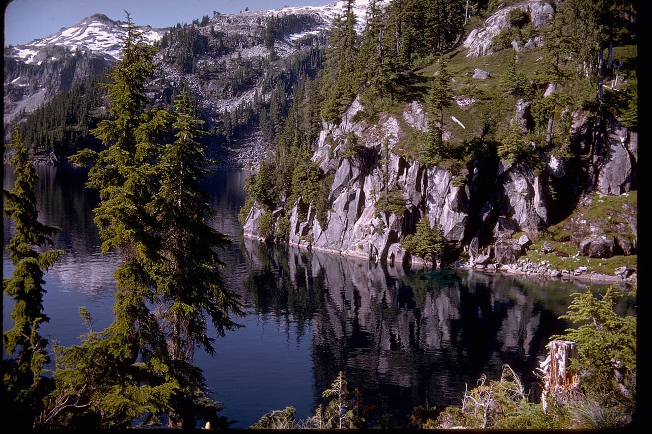
North Cascades National Park · Washington
Stunning alpine traverse.
Get an alert when a night opens on your Copper Ridge dates.
Source: recreation.gov
70% of the openings our scanner caught on Copper Ridge were gone within 10 minutes.
The loop is 33.5 miles from Hannegan Pass Trailhead, and it climbs from 2,541 ft to 6,271 ft at Copper Ridge Lookout. There are 6 places to camp on the loop.
Elevation 4,433 ft
Capacity: 2 reservable sites + 1 walk-up, 4 people per site
Five miles and 2,000 feet in, hiker and stock, three sites of four. No campfires. The last water before the ridge.
Copper Ridge Loop, stop by stop from Hannegan Pass Trailhead
9 of 9 places in this section
Trailhead
MI 0 · 3,114 ft
End of USFS Road 32 off the Mt. Baker Highway. Parking requires a Northwest Forest Pass or America the Beautiful pass.
Terrain USGS 3DEP · Water USGS NHD · Trail © OpenStreetMap contributors
As of September 2026, Copper Ridge in North Cascades National Park, Washington requires a permit issued via reservation. Copper Ridge is a high-demand permit, rating 7/10 on PermitSnag's demand index. Cancelled Copper Ridge permits are re-released on the booking system, and PermitSnag alerts you the moment one opens. The Copper Ridge lottery opens March 2, 2026 and closes March 13, 2026, 9:00 pm PT, with results announced March 20, 2026. Awarded applicants book March 24 to April 21; general on-sale April 29 at 7:00 am PT. The Copper Ridge route covers 33.5 miles, rated strenuous.
Sign up at National Park Service if you don't have an account. Have your payment info ready.
Permits release on a rolling basis. Check the release time for your dates.
Log in a few minutes early. Have your dates, group size, and payment ready to go.
If your dates are sold out, people cancel all the time. Set up PermitSnag alerts to catch openings instantly.
More on Copper Ridge: Live availability activityWhen Copper Ridge permits open upCopper Ridge Loop permit itineraryDo I need a Copper Ridge Loop permit?
Copper Ridge permit fee: $10 per person per trip for adults 16 and over, youth free, plus a $6 non-refundable reservation fee.
A high ridge with a fire lookout at about 6,270 feet, a precipitous 2,400-foot drop in five miles to the Chilliwack River, and a cable car to get across it when the water is up.
The Copper Ridge loop runs from the Hannegan Pass Trailhead at about 3,100 feet over Hannegan Pass at 5,100, along a 13.9-mile ridge past the Copper Ridge Lookout at about 6,270 feet, then down a descent the park describes as precipitous (2,400 feet in five miles) to the Chilliwack River, and back out. It publishes five miles and 2,000 feet to Boundary Camp, the Copper Ridge Trail at 13.9 miles gaining 1,817 feet from Boundary or 4,170 from the Chilliwack, and the Chilliwack River Trail at 17.3 miles.
Three camps sit on the ridge (Silesia, Egg Lake and Copper Lake), each with composting toilets and food storage lockers, each with sites capped at four people, and none allowing campfires. Fires are also prohibited at Boundary and Whatcom camps.
Water governs the itinerary. The park's guidance is that the Copper Ridge trail is hot and dry in summer and to carry enough water; that in summer there is no water between Boundary Camp and the ridge; that ridge water is available at Copper and Egg Lakes; that Silesia has no water once the snow melts, requiring a one-mile round trip to Egg Lake; and that there is no reliable water between one mile east of Copper Lake and the Chilliwack River.
Fire closures have reshaped the loop. As of the park's August 7, 2026 closure list, the U.S. Cabin Stock Camp, Graybeal and Graybeal Stock camps and Whatcom Camp are closed, and the trail is closed beyond Whatcom Pass. Graybeal, Graybeal Stock and Whatcom are closed due to fire damage from 2022; Bear Creek camp has been closed since a 2021 fire; and Little Chilliwack Camp no longer exists because the Chilliwack River changed course.
On the ground in 2026, the park reported on August 5 that the trail crew had logged out the entirety of the Copper Loop and flagged a new landslide on the bottom of the north switchbacks, and that the lower Chilliwack from Brush Creek to Indian Creek had been cleared and brushed through the burn scar. On July 12 it noted the Chilliwack crossing running high enough that groups should be prepared with good stream-crossing tactics, crossing early in the morning with trekking poles, and a debris flow just east of the crossing that can be tricky to navigate.
Permits are the park complex's standard: $10 per person for adults 16 and over, youth free, plus $6 non-refundable. The 2026 early-access lottery ran March 2 to 13, results March 20, awarded booking March 24 to April 21, general on-sale April 29 at 7:00 am PT. Roughly 60% of sites are reservable in advance with the rest held for walk-ups up to 24 hours ahead. Reservations are not allowed for trips in this area starting before July 1, and the park's stated prime season is mid-July to mid-September. The camps stay snow-covered into July, and the park warns that attempting the ridge before the snow melts is dangerous, with proficiency on steep snow with an ice axe and readiness for high creek crossings both required.
Check the status of Hannegan Pass Road (USFS Road 32) with the Forest Service before you drive.
The park publishes the pieces: five miles and 2,000 feet of gain to Boundary Camp, rated moderate; the Copper Ridge Trail itself at 13.9 miles, gaining 1,817 feet from Boundary or 4,170 feet from the Chilliwack River, rated strenuous and hiker-only; and the Chilliwack River Trail at 17.3 miles with 2,365 feet of loss. Elevations run from about 3,100 feet at the trailhead through Hannegan Pass at 5,100 and the Copper Lookout at about 6,270, with Whatcom Pass at 5,206.
Water is the defining problem. The park says the Copper Ridge trail is hot and dry in the summer and to carry enough water, and then gets specific: in summer there is no water between Boundary Camp and the ridge; water on the ridge is available at Copper and Egg Lakes; there is no water at Silesia Camp once the snow melts, so you fetch it from Egg Lake on a one-mile round trip; and there is no reliable water between one mile east of Copper Lake and the Chilliwack River.
The river crossing is the other. The park's instruction is to ford the Chilliwack River only at low water and use the cable car crossing at other times. During late July and August the river is often less than knee deep. The cable car was replaced in October 2019.
The Copper Ridge and Chilliwack loop is the classic multi-day route in the north end of the park complex, and the park calls it one of the most popular backcountry destinations, with permits difficult to obtain during busy periods. It is also the loop most changed by fire: several Chilliwack-side camps have been closed since a 2022 burn and the trail is closed beyond Whatcom Pass.
Miles of open ridge with the Pickets to the south and Canada to the north, and no water anywhere on it. Then the ridge ends and drops you 2,400 feet in five miles into rainforest and a river you either ford or ride a cable car across.
Best for: Experienced backpackers who will carry water properly and can read a river. The ridge walking itself is the reward.
Recommended experience: Multi-day backpacking, stream-crossing judgement, and steep-snow travel for an early trip. The exposure rating covers the precipitous 2,400-foot descent, the ford and the snow, not technical climbing.
Not recommended for: Parties who cannot ford moving water or use a cable car, and anyone going before mid-July without an ice axe.
Trailhead information
NPS names the Mount Baker Highway / SR 542 corridor, and Hannegan Pass and Copper Ridge within it, as the access for this loop.
Trailhead information
10091 Mt. Baker Hwy, Glacier, WA 98244. NPS describes it as a U.S. Forest Service ranger station jointly staffed by National Park Service wilderness rangers during the summer season.
Glacier, Washington.
In-person permit pickup Thursdays and Fridays only, between June 25 and September 25, covering the Chilliwack and Copper Ridge trails, Whatcom Pass and the Fisher Chimneys route on Mount Shuksan. Bear canisters are loaned here.
Mid-July to mid-September, which is the park's own stated prime season for the Copper Ridge area. Camps stay snow-covered into July, reservations are not accepted for trips starting before July 1, and the park warns that attempting the ridge before the snow melts is dangerous. Late July and August also give the lowest water at the Chilliwack ford.
Trailhead (5,000 ft)
Backcountry Tips
Today
53°
39°
47%
Tue
47°
40°
100%
Wed
52°
37°
Thu
61°
36°
34%
Fri
60°
43°
35%
Sat
67°
42°
Sun
70°
46°
Sunset from the ridge near the lookout, with the Pickets to the south catching the last light.
Clear mornings on the ridge before the haze builds. The Chilliwack valley below stays in shade most of the day.
Hannegan Pass takes the day-hikers. Past Boundary Camp the numbers drop hard, and the Chilliwack side is emptier still now that three camps are closed.
Emergency contacts, ranger station locations, and satellite communicator tips for Copper Ridge.
Bear canister requirements, approved container lists, and rental locations for this permit.
Gear Checklist: Required and recommended gear for Copper Ridge · Shuttle Services: Trailhead transportation options · Guide Services: Experienced wilderness guides
Some links may be affiliate links. Purchases support PermitSnag at no extra cost to you.
Yes. You need a North Cascades National Park backcountry permit, required year-round for all overnight trips. It costs $10 per person for adults 16 and over, youth free, plus a $6 non-refundable reservation fee.
Very little, and this is the thing to plan around. The park says the trail is hot and dry in summer and to carry enough water. In summer there is no water between Boundary Camp and the ridge; on the ridge it is available at Copper and Egg Lakes only; Silesia Camp has none once the snow melts, so you fetch water from Egg Lake on a one-mile round trip; and there is no reliable water between one mile east of Copper Lake and the Chilliwack River.
Ford it only at low water and use the cable car crossing at other times. That is the park's own instruction. During late July and August the river is often less than knee deep. The cable car was replaced in October 2019. On July 12, 2026 the park reported the crossing running high enough that groups should cross early in the morning with trekking poles and good stream-crossing technique.
As of the park's August 7, 2026 closure list: Whatcom Camp, Graybeal, Graybeal Stock and the U.S. Cabin Stock Camp, and the trail is closed beyond Whatcom Pass. Graybeal, Graybeal Stock and Whatcom are closed for fire damage from 2022; Bear Creek has been closed since a 2021 fire; and Little Chilliwack Camp no longer exists because the river changed course.
The park gives the loop as 33.5 miles over four to six days, and publishes the pieces: five miles and 2,000 feet of gain to Boundary Camp, the Copper Ridge Trail at 13.9 miles gaining 1,817 feet from Boundary or 4,170 feet from the Chilliwack River, and the Chilliwack River Trail at 17.3 miles. The descent off the ridge drops 2,400 feet in five miles.
Check the road status with the Mt. Baker-Snoqualmie National Forest before you go. The road runs 5.5 miles from the Mt. Baker Highway, 8.5 miles past the town of Glacier, and parking requires a Northwest Forest Pass or America the Beautiful pass.
Four per site at Silesia, Egg Lake, Copper Lake and Boundary. The park's overall group limit is 12 within all trail corridors and camps, including people and stock, but it notes that due to terrain constraints not all camps can accommodate 12. None of these can.
No active conditions reported
Sign in to report trail conditions.
No questions yet
Be the first to ask about Copper Ridge.
Sahale Glacier Camp at 7,600 feet, 5.9 miles and 3,940 feet from the Cascade River Road.
Shorter, wetter and far more scenic per mile, but only six sites at Sahale and the permits must be collected in Marblemount.
The park complex's general wilderness permit, covering all camps and cross-country zones.
Same fees and lottery, and a much wider choice when the Chilliwack closures rule out the classic loop.
Olympic's 18.2-mile High Divide loop with alpine lakes and a ridge facing Mount Olympus.
Similar ridge walking with far more water on it, but bear canisters are mandatory and the whole summer releases on one April morning.
Build your full itinerary start to finish
Add your dates and get a day-by-day plan: what needs a permit, what gear to bring, and one link to share with your whole group to coordinate every step.
No permit needed to start
Google lets you pick the sites it highlights for you. Add PermitSnag and our permit pages get marked as one of yours in AI Overviews and AI Mode.
Takes less than a minute.