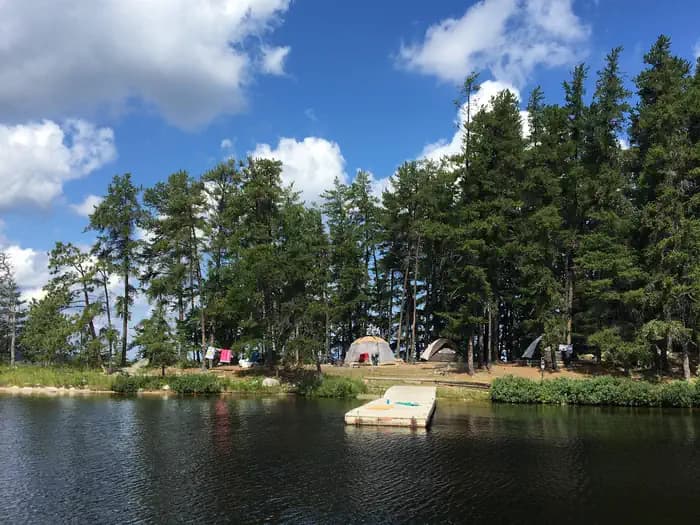
Voyageurs National Park Camping Permits Campground
Voyageurs National Park, Minnesota
Sold out? We check Voyageurs National Park Camping Permits Campground for cancellations and email you the moment a site opens.
Cancellation alerts
Sold out for your dates?
Free to start. Email alerts included.
As of September 2026, Voyageurs National Park Camping Permits Campground is a campground in Voyageurs National Park, Minnesota with 159 campsites. Voyageurs National Park Camping Permits Campground is booked through Recreation.gov.
- PermitSnag checks Voyageurs National Park Camping Permits Campground for availability and tells alert holders when a site opens up.
- Voyageurs National Park Camping Permits Campground is located at 48.6028° N, 93.3768° W.
- people allowed on 112 of 159 sites
- 9
- people allowed on each of the 2 largest sites
- 30
Voyageurs National Park Camping Permits Campground reservations and next available dates
September 2026
Stay and booking rules
- Mid-stay changes allowed
- Changes allowed: 10 change(s) per reservation
- Campsites held at once: 1 campsite(s) held
- Maximum consecutive stay: 14 consecutive days
- Maximum reservations at once: 20 reservations
- Maximum stay: 30 days
- Maximum per transaction: 1 reservations per transaction
- Minimum stay: 1 consecutive nights
- Book up to: 12 Months
Published by Recreation.gov for Voyageurs National Park Camping Permits Campground, read on September 30, 2026.
Campsites at Voyageurs National Park Camping Permits Campground
- Boat-in 143
- Standard 16
- Accessible 5
- Hookups 2
Amenities
- potable water
At a glance: Setting: Forest.
Things to do: fishing, boating, swimming, hiking, wildlife, photography, stargazing.
All sites at Voyageurs National Park Camping Permits Campground, as listed by Recreation.gov
| Site | Loop | Type | Sleeps | Hookups | Access |
|---|---|---|---|---|---|
| Agnes Lake B1 | Backcountry | Standard | 6 | - | - |
| Brown Lake B3 | Backcountry | Standard | 6 | - | - |
| Cruiser Lake B5 | Backcountry | Standard | 6 | - | - |
| Ek Lake B6 | Backcountry | Standard | 6 | - | - |
| Jorgens Lake B7 | Backcountry | Standard | 6 | - | - |
| Locator Lake B9 | Backcountry | Standard | 6 | - | - |
| Loiten Lake B11 | Backcountry | Standard | 6 | - | - |
| Oslo Lake B12 | Backcountry | Standard | 6 | - | - |
| Peary Lake B13 | Backcountry | Standard | 6 | - | - |
| Quarter Line Lake B14 | Backcountry | Standard | 6 | - | - |
| Quill Lake B15 | Backcountry | Standard | 6 | - | - |
| Ryan Lake B18 | Backcountry | Standard | 6 | - | - |
| Shoepack B8 & Little Shoepack Lakes B19 | Backcountry | Standard | 6 | - | - |
| War Club Lake B17 | Backcountry | Standard | 6 | - | - |
| Bald Rock K1 | Kabetogama Lake | Boat-in | 18 | - | - |
| C. Vic Linsten K5 | Kabetogama Lake | Boat-in | 18 | - | - |
| Camel Back Island K3 | Kabetogama Lake | Boat-in | 9 | - | - |
| Cutover Island South K6 | Kabetogama Lake | Boat-in | 9 | - | - |
| Eagle View K7 | Kabetogama Lake | Boat-in | 9 | - | - |
| Echo Island K41 | Kabetogama Lake | Boat-in | 18 | - | - |
| Eks Bay K8 | Kabetogama Lake | Boat-in | 18 | - | - |
| Fox Farm K50 | Kabetogama Lake | Boat-in | 9 | - | - |
| Grassy Islands South K9 | Kabetogama Lake | Boat-in | 9 | - | - |
| Happy Landing K11 | Kabetogama Lake | Boat-in | 9 | - | - |
| Kabetogama Lake Group K54 | Kabetogama Lake | Boat-in | 30 | - | Accessible |
| La Bontys Point K14 | Kabetogama Lake | Boat-in | 9 | - | - |
| Lost Bay (Kab) K16 | Kabetogama Lake | Boat-in | 9 | - | - |
| Lost Bay Island K17 | Kabetogama Lake | Boat-in | 9 | - | - |
| Lost Lake K19 | Kabetogama Lake | Boat-in | 9 | - | - |
| Maple Point K21 | Kabetogama Lake | Boat-in | 9 | - | - |
| Marrs Point East K55 | Kabetogama Lake | Boat-in | 18 | - | - |
| Moxie Island K22 | Kabetogama Lake | Boat-in | 9 | - | - |
| Northland K24 | Kabetogama Lake | Boat-in | 9 | - | - |
| Peterson Point K25 | Kabetogama Lake | Boat-in | 9 | - | - |
| Pine Point K45 | Kabetogama Lake | Boat-in | 9 | - | - |
| Round Bear Island K29 | Kabetogama Lake | Boat-in | 9 | - | - |
| Shelter Bay K30 | Kabetogama Lake | Boat-in | 9 | - | - |
| Sphunge Island East K31 | Kabetogama Lake | Boat-in | 9 | - | - |
| Sphunge Island West K53 | Kabetogama Lake | Boat-in | 9 | - | - |
| Sugarbush Island K34 | Kabetogama Lake | Boat-in | 9 | - | - |
| Windigo K35 | Kabetogama Lake | Boat-in | 9 | - | - |
| Wood Duck Island K36 | Kabetogama Lake | Boat-in | 9 | - | - |
| Aspen Bench N57 | Namakan Lake | Boat-in | 9 | - | - |
| Birch Cove Island N1 | Namakan Lake | Boat-in | 9 | - | - |
| Catamaran N15 | Namakan Lake | Boat-in | 9 | - | - |
| Day Marker 23 N5 | Namakan Lake | Boat-in | 18 | - | - |
| Depthfinder Island N7 | Namakan Lake | Boat-in | 9 | - | - |
| Fox Island N10 | Namakan Lake | Boat-in | 9 | - | - |
| Hammer Bay Point N69 | Namakan Lake | Boat-in | 9 | - | - |
| Hammer Bay South N59 | Namakan Lake | Boat-in | 9 | - | - |
| Hoist Bay N12 | Namakan Lake | Boat-in | 9 | - | - |
| Johnson Bay N13 | Namakan Lake | Boat-in | 9 | - | - |
| Junction Bay N14 | Namakan Lake | Boat-in | 9 | - | - |
| Kettle Portage N16 | Namakan Lake | Boat-in | 9 | - | - |
| Leach Bay N3 | Namakan Lake | Boat-in | 9 | - | - |
| Mcmanus Island West N18 | Namakan Lake | Boat-in | 9 | - | - |
| Mica Island N20 | Namakan Lake | Boat-in | 9 | - | - |
| My Island South N24 | Namakan Lake | Boat-in | 9 | - | - |
| My Island West N25 | Namakan Lake | Boat-in | 9 | - | - |
| Namakan Entrance N26 | Namakan Lake | Boat-in | 9 | - | - |
| Namakan Island East N27 | Namakan Lake | Boat-in | 9 | - | - |
| Namakan Island Northeast N55 | Namakan Lake | Boat-in | 18 | - | - |
| Namakan Island South N63 | Namakan Lake | Boat-in | 9 | - | - |
| Namakan Island West N28 | Namakan Lake | Boat-in | 9 | - | - |
| North Mitchell Island N58 | Namakan Lake | Boat-in | 9 | - | - |
| Old Dutch Bay N29 | Namakan Lake | Boat-in | 9 | - | - |
| Pat Smith Island N30 | Namakan Lake | Boat-in | 9 | - | - |
| Pike Bay N31 | Namakan Lake | Boat-in | 9 | - | - |
| Rainbow Island N33 | Namakan Lake | Boat-in | 9 | - | - |
| Rusty Island N35 | Namakan Lake | Boat-in | 9 | - | - |
| Sandbar Point N37 | Namakan Lake | Boat-in | 9 | - | - |
| Sexton Island N62 | Namakan Lake | Boat-in | 9 | - | - |
| Sheen Point N38 | Namakan Lake | Boat-in | 9 | - | - |
| Steakhouse Point N42 | Namakan Lake | Boat-in | 9 | - | - |
| Torry Fish Camp N43 | Namakan Lake | Boat-in | 18 | - | - |
| Voyageur Narrows N41 | Namakan Lake | Boat-in | 9 | - | Accessible |
| Williams Island North N61 | Namakan Lake | Boat-in | 9 | - | - |
| Williams Island South N44 | Namakan Lake | Boat-in | 9 | - | - |
| Windbreak Point N45 | Namakan Lake | Boat-in | 9 | - | - |
| Wolf Pack Island East N48 | Namakan Lake | Boat-in | 9 | - | - |
| Site | Loop | Type | Sleeps | Hookups | Access |
|---|---|---|---|---|---|
| Wolf Pack Island West N46 | Namakan Lake | Boat-in | 18 | - | - |
| Your Island N49 | Namakan Lake | Boat-in | 9 | - | - |
| Blueberry Ridge H2 | Primitive | Standard | 6 | - | - |
| Red Pine H1 | Primitive | Standard | 6 | - | - |
| Alder Creek R1 | Rainy Lake | Boat-in | 9 | - | - |
| Anderson Bay West R90 | Rainy Lake | Boat-in | 9 | - | - |
| Arden Island R4 | Rainy Lake | Boat-in | 9 | - | - |
| Beaver Lodge R54 | Rainy Lake | Boat-in | 9 | - | - |
| Big Island R5 | Rainy Lake | Boat-in | 18 | Electric | - |
| Blueberry Island West R92 | Rainy Lake | Boat-in | 18 | - | - |
| Breakwater Cove R6 | Rainy Lake | Boat-in | 9 | - | - |
| Channel View R100 | Rainy Lake | Boat-in | 9 | - | - |
| Cranberry Creek R95 | Rainy Lake | Boat-in | 9 | - | - |
| Diamond Island South R10 | Rainy Lake | Boat-in | 18 | - | - |
| Dove Bay West R111 | Rainy Lake | Boat-in | 9 | - | - |
| Dryweed Island North R73 | Rainy Lake | Boat-in | 9 | - | - |
| Dryweed Island R11 | Rainy Lake | Boat-in | 9 | - | - |
| Finlander Island R59 | Rainy Lake | Boat-in | 9 | - | - |
| Fish Camp Island R13 | Rainy Lake | Boat-in | 9 | - | - |
| Hanson R14 | Rainy Lake | Boat-in | 9 | - | - |
| Harrison Bay R61 | Rainy Lake | Boat-in | 18 | - | - |
| Hitchcock Island R105 | Rainy Lake | Boat-in | 9 | - | - |
| Jack Pine Bench R55 | Rainy Lake | Boat-in | 9 | - | - |
| Kawawia Island R16 | Rainy Lake | Boat-in | 18 | - | - |
| Kempton Entrance East R91 | Rainy Lake | Boat-in | 9 | - | - |
| Krantz Point R62 | Rainy Lake | Boat-in | 18 | - | - |
| Little Finlander Island R18 | Rainy Lake | Boat-in | 9 | - | - |
| Logging Camp R19 | Rainy Lake | Boat-in | 9 | - | - |
| Loon Bay R63 | Rainy Lake | Boat-in | 18 | - | - |
| Loon Cove R71 | Rainy Lake | Boat-in | 9 | - | - |
| Lost Bay (Rainy) R20 | Rainy Lake | Boat-in | 18 | - | - |
| Lyle Mine Island R93 | Rainy Lake | Boat-in | 18 | - | - |
| Makinen Point R53 | Rainy Lake | Boat-in | 9 | - | - |
| Mio Beach R64 | Rainy Lake | Boat-in | 9 | - | - |
| Nelson Island R102 | Rainy Lake | Boat-in | 9 | - | - |
| Nuthatch R21 | Rainy Lake | Boat-in | 9 | - | - |
| Pine Island View R103 | Rainy Lake | Boat-in | 9 | - | - |
| Rainy Lake Group R74 | Rainy Lake | Boat-in | 30 | - | Accessible |
| Reuter Creek R65 | Rainy Lake | Boat-in | 18 | - | - |
| Rock Shelf R72 | Rainy Lake | Boat-in | 9 | - | - |
| Saginaw Bay R22 | Rainy Lake | Boat-in | 9 | - | - |
| Saginaw Bay West R104 | Rainy Lake | Boat-in | 9 | - | Accessible |
| Shelland Island R106 | Rainy Lake | Boat-in | 18 | - | - |
| Soboleski Bay South R49 | Rainy Lake | Boat-in | 9 | - | - |
| Stones Point R67 | Rainy Lake | Boat-in | 9 | - | - |
| Sunrise Point R26 | Rainy Lake | Boat-in | 9 | - | Accessible |
| Tango Channel R101 | Rainy Lake | Boat-in | 9 | - | - |
| Three Sisters Island R77 | Rainy Lake | Boat-in | 18 | - | - |
| Virgin Island South R27 | Rainy Lake | Boat-in | 18 | - | - |
| Whites Point R47 | Rainy Lake | Boat-in | 9 | - | - |
| Windmill Rock View R56 | Rainy Lake | Boat-in | 9 | - | - |
| Browns Bay S1 | Sand Point Lake | Boat-in | 9 | - | - |
| Browns Bay View S3 | Sand Point Lake | Boat-in | 18 | - | - |
| Burnt Island S4 | Sand Point Lake | Boat-in | 9 | - | - |
| Feldt Channel S5 | Sand Point Lake | Boat-in | 9 | - | - |
| Granite Cliff North S6 | Sand Point Lake | Boat-in | 9 | - | - |
| Granite Cliff South S7 | Sand Point Lake | Boat-in | 9 | - | - |
| Grassy Bay South S23 | Sand Point Lake | Boat-in | 9 | - | - |
| Houseboat Island West S9 | Sand Point Lake | Boat-in | 9 | - | - |
| Ingersoll Cove S30 | Sand Point Lake | Boat-in | 18 | - | - |
| Jensen Bay S27 | Sand Point Lake | Boat-in | 18 | - | - |
| King Pin S10 | Sand Point Lake | Boat-in | 18 | - | - |
| King Williams Narrows S11 A | Sand Point Lake | Boat-in | 9 | - | - |
| King Williams Narrows S11 B | Sand Point Lake | Boat-in | 9 | - | - |
| King Williams Narrows S11 C | Sand Point Lake | Boat-in | 9 | - | - |
| King Williams Narrows S11 D | Sand Point Lake | Boat-in | 9 | - | - |
| King Williams Narrows S11 E | Sand Point Lake | Boat-in | 9 | - | - |
| Mukooda Lake - Bass S12 A | Sand Point Lake | Boat-in | 18 | - | - |
| Mukooda Lake - Crappie S12 B | Sand Point Lake | Boat-in | 9 | - | - |
| Mukooda Lake - Trout S12 C | Sand Point Lake | Boat-in | 9 | - | - |
| North Island West S13 | Sand Point Lake | Boat-in | 9 | - | - |
| Norway Island S14 | Sand Point Lake | Boat-in | 18 | - | - |
| Partridge Point S28 | Sand Point Lake | Boat-in | 18 | - | - |
| Reef Island S15 | Sand Point Lake | Boat-in | 9 | - | - |
| Sand Point S29 | Sand Point Lake | Boat-in | 9 | - | - |
| South Island S17 | Sand Point Lake | Boat-in | 9 | - | - |
| Stoneburner Island S18 | Sand Point Lake | Boat-in | 9 | Electric, Water | - |
| Swansons Bay S24 | Sand Point Lake | Boat-in | 9 | - | - |
| Wolf Island S19 | Sand Point Lake | Boat-in | 9 | - | - |
About Voyageurs National Park Camping Permits Campground
Overview
** PLEASE READ IMPORTANT INFORMATION BELOW TO UNDERSTAND HOW TO CAMP AT VOYAGEURS NATIONAL PARK **
All frontcountry and backcountry campsites require travel by private watercraft or water taxi to access.
Click on any campsite name when searching sites to view boating distances.
You can type in a specific campsite number or campsite/lake name when searching site availability.
Voyageurs National Park has 143 frontcountry, 14 backcountry, and 2 primitive campsites for visitors wanting an authentic Northwoods camping experience.
PRIMITIVE CAMPSITES (Red Pine & Blueberry Ridge) are the only campsites that are located on the mainland and DO NOT require a boat to access. They are hike-in sites along the Kab-Ash Trail and are equipped only with fire rings and cleared areas for tents. Leave No Trace Principles apply in these areas.
FRONTCOUNTRY CAMPSITES are located on the large lakes (Rainy, Kabetogama, Namakan, Sandpoint). You can boat directly to them from any park visitor center boat ramp. They offer fire rings, tent pads, picnic tables, bear lockers for safe food storage, and outdoor privies. Ten of the frontcountry sites throughout the park are available on a one-week booking window to accommodate short-term trip planners.
BACKCOUNTRY CAMPSITES are located on the park's interior lakes and offer a more remote and secluded camping experience consisting of fire rings, tenting areas, an outdoor privy, a bear pole for safe food storage, and a canoe. These sites first require travel by private watercraft or local water taxi service to a remote trailhead and then hiking up to several miles to the backcountry lakes. All backcountry campsite reservations include the use of one canoe and an access code will be provided in your confirmation email. Some campsites can be hiked to directly while others require paddling after hiking. Canoes on backcountry lakes are provided by the park and remain stationed at these lakes. Personal watercrafts of any kind cannot be portaged into backcountry due to the threat of Aquatic Invasive Species.
Chain of Lakes (Locator, War Club, Quill, and Loiten Lakes): Reservations at these sites automatically include one canoe because a canoe is required to reach them. In this area only, up to 2 additional canoes can be added on a first come, first served basis to any camping reservation.
Shoepack & Little Shoepack Lakes: The campsites on these two lakes come reserved together (for the cost of one) because the one canoe on Little Shoepack is required to reach the campsite on Little Shoepack and/or the portage to Shoepack Lake. Shoepack Lake has its own separate canoe - please leave the canoes on their respective lakes.
Ek, Agnes, Jorgens, Quarter Line, Cruiser, Brown, Peary, Oslo and Ryan Lakes: These backcountry campsites can be hiked to directly after boating to a trailhead and have one canoe located at each site.
DAY USE BACKCOUNTRY CANOE RENTALS: The Chain of Lakes is the only backcountry area with an additional inventory of canoes that are available for single day use. Use of these canoes first requires travel by private watercraft or local water taxi service to the Locator trailhead and then hiking two miles to where the rental canoes are stationed. To reserve a day use canoe in the Chain of Lakes area, click on the Reserve Day Use button on this page to view availability. To use the canoe at any other backcountry site for day use, that campsite must be reserved for one overnight.
DAY USE & VISITOR DESTINATION SITES: With 27 Day Use sites and 7 Visitor Destination sites, Voyageurs National Park has plenty of areas to enjoy for visitors who are out for a day trip on the lakes. Each Day Use site has picnic tables, fire rings and vault privies, while the Visitor Destination sites offer short trails with wayside exhibits, picnic areas and comfort stations. No reservations are required for Day Use or Destination sites. You can view a map of day use sites here .
Keep Voyageurs National Park Wild for Future Generations: The Voyageurs Conservancy is the park's official nonprofit partner representing a community of people who care about the ongoing stewardship of Voyageurs National Park. VNPA works to fund projects and programs that will help sustain the park's waters, wild character, and visitor experience for generations to come. Become a member today , follow them on Facebook and Instagram , or sign up for their e-newsletter .
Recreation
From spring through fall, explore Voyageurs National Park on land by stopping in at a visitor center or hiking any of our 52 miles (84 km) of scenic hiking trails. To explore the vastness of the same lakes the Voyageurs and Ojibwe Indians once traversed, leave your car behind and explore park waters by kayak, canoe, sailboat, motorboat, houseboat or tour boat. Public boat launch ramps are available at park visitor centers, the Crane Lake ranger station and the two state forest campgrounds - Woodenfrog and Ash River.
With scheduled programs and boat tours, you can paddle a canoe on the Voyageurs Highway, watch wildlife by day and stars by night, and explore historic Kettle Falls Hotel, Hoist Bay and Ellsworth Rock Gardens. Check the Things to Do page on the park website for a current list of these activities and many more, or speak with a park ranger at one of the Voyageurs National Park visitor centers. Many of our programs offer reservations. Visit the Voyageurs National Park Tours or the Voyageurs National Park Special Interpretive Programs pages (reservations are highly recommended for boat tours).
Facilities
Voyageurs National Park has three visitor centers, which offer area information, exhibits, a park movie, bookstore, Junior Ranger programs, boat ramps, hiking trials and more. All visitor centers are open daily in the summer, and re open limited hours in the fall, winter, and spring.
Raniy Lake Visitor Center (218) 286-5258
Kabetogama Lake Visitor Center (218) 875-2111
Ash River Visitor Center (218) 374-3221
Natural Features
Voyageurs National Park is a land and water environment of great beauty, exceptional natural and cultural resources, and abundant recreational opportunities. Located in the lake-country of northern Minnesota, the park protects 218,054 acres (88,243 ha) that include roughly 134,000 acres (54,227 ha) of forest, 84,000 acres (33,993 ha) of water, 655-miles (1,054 km) of undeveloped shoreline, and hundreds of islands. The park's 55-mile (89 km) northern boundary is the international border between the United States and Canada and includes an important segment of the "transcontinental highway" traversed by French-Canadian voyageurs during the late 1700s and early 1800s.
There are four distinct seasons in Voyageur country. The air is mild during June, July, and August when periods of fine, warm weather prevail. The frost-free season averages 120 days from June to mid-September. The average ice-out date is May 3 but varies year to year. Annual precipitation (rain and snow) averages 25-28 inches (63-71 cm) in the park and average snowfall ranges from 55-70 inches (140-180 cm), but is highly variable. The first measurable snowfall occurs in late October and the last in late April or early May.
Nearby Attractions
Unique attractions near Voyaguers National Park:
The City of International Falls sits on the U.S.-Canada borde r, across from Fort Frances, Ontario. You can have a picnic lunch in Smokey Bear Park, and then tour the Bronko Nagurski Museam and Koochiching County Historical Museum, which both sit on site. Don't forget to take a photo with the 26-foot statue of Smokey the Bear himself - a well-known and beloved national symbol of fire prevention and forest conservation. There are many unique businesses and shops along main street, as well as some great coffee shops and restaurants. Heading eastward out of town, you will pass the village of Ranier and numerous resorts where you can find delicious lake-side dining, fishing guides, hotel and cabin accomodations, houseboat rental companies and much more.
The Historic Port Village of Ranier is a quaint little community situa ted right where Rainy Lake empties into the Rainy River underneath a cantilever-style train bridge that spans from the U.S. into Canada. Here you will find lodging, an RV park, a park and playground, a public beach, public docks, delicous food, an ice cream parlor and a lakeside brewpub, all packed into one small charming town of about 150 residents. Be sure to take a photo with Big Vic, the 25-foot (8 m) tall statue of a French-Canadian voyageur, who stands at the entrance to this unique little town.
The communites of Kabetogama , and Ash River , and Crane Lake are located 30 to 60 miles south of International Falls, and serve as gateways to the southern district Voyageurs National Park. Be sure to stop and take a photo of yourself "riding" the walleye statue at the entrance to Kabetogama on Highway 53.
Contact Info
For facility specific information, please call (218) 283-6650.
Charges & Cancellations
CANCELLATION POLICY: Cancellations and/or modifications to an existing reservation can easily be made online via your recreation.gov account. Log in to your account, click on your name in the upper right, and select My Reservations. Click on the "Modify or Cancel" button next to the reservation needing to be changed. The national recreation.gov call center at (877) 444-6777 can also assist. You cannot call a park office to cancel a reservation.
THE FOLLOWING FEES APPLY:
- Reservation system fee of $10 charged at time of reservation is non-refundable
- Any change (i.e. trip dates, campsite) to your reservation more than 3 days prior to your trip: No charge
- Any change (i.e. trip dates, campsite) to your reservation less than 3 days prior to your trip: $10 service fee per
- Cancel reservation more than 3 days prior to arrival date: additional $10 cancellation fee; receive refund of remaining amenity fees
- Cancel reservation less than 3 days prior to arrival date: additional $10 cancellation fee + forfeit first night’s fee; receive refund of remaining amenity fees
- Once permit has been printed: No refund; printing your permit confirms your reservation and must be done within 5 days of your trip start date from the My Reservations section of your recreation.gov account
- Once trip dates have started: No refund; if you are unable to make your trip, cancel your reservation in the My Reservations section of your recreation.gov account before your trip start date to be eligible for a refund
Rules and notices at Voyageurs National Park Camping Permits Campground
Recreation.gov does not date these notices. We last read them on September 30, 2026. Check Voyageurs National Park Camping Permits Campground on Recreation.gov
Notices from Recreation.gov
It is required to view the Voyageurs National Park Camping Video in its entirety prior to payment.
You are responsible for ensuring all information contained within the Voyageurs National Park Camping Video is acknowledged and followed by all members of your group.
Permits: You must log into your recreation.gov account to print your permit and bring it with you to your site. Five days prior to your trip , the Print Permit button will be enabled in the Reservations section of your recreation.gov account. Chrome or Edge are the recommended browser for recreation.gov. NOTE: permits currently cannot be printed via the rec.gov app - please print directly from www.recreation.gov.
Display your permit in the waterproof box provided on the bear locker at your frontcountry site. In the backcountry, keep your permit with you.
Access: All frontcountry and backcountry sites require travel by boat . You must use your own private watercraft, or arrange for boat rental or water taxi from these options to reach frontcountry campsites or backcountry trailheads.
Check-in / Check-out Times:
- •Frontcountry: You may arrive at your site any time after 3:00 p.m. on your first day, and depart no later than 12:00 noon on your day of departure.
- •Backcountry: You may arrive at your site any time after 12:00 noon on your first day, and depart no later than 11:00 a.m. on your day of departure. Be mindful that another visitor may be waiting for your canoe to be returned to the launch area.
SPECIAL CONSIDERATIONS IN THE BACKCOUNTRY:
- •These sites first require travel by private watercraft or water taxi to a trailhead, and then hiking up to several miles to the campsite. Private watercrafts must be left at the trailhead and not portaged into backcountry lakes. Once in the backcounty, a combination code is needed to unlock and use the park's canoes. Be certain that you have made a reservation and and bring your permit as it will include this information.
- •To prevent the spread of aquatic invasive species: private watercrafts cannot be portaged into backcountry lakes, nor can float planes land on them; use artificial bait only; all gear must be decontaminated or dried for 5 days prior to using in backcountry lakes; clean all water, plants, mud, etc. from gear before leaving a lake.
- •Bring in and wear your own Personal Flotation Device (PFD) ; only canoes and paddles are provided with a canoe reservation.
- •Bring rope to hang food in case a bear pole is not present, and always treat lake water before using it for drinking or cooking.
Campfires :
•
Fires are allowed in designated metal fire rings only. Do not burn trash , pack everything out - there are trash and recycling receptacles at the boat landings.
•
Lighting or maintaining a fire with flammable liquids, garbage, fireworks, plastics, aerosol canisters, batteries, or other manufactured materials not designed for fire lighting or maintenance is prohibited . See 36 CFR § 2.13(a)(1) for full details.
Bear Safety : Use the provided bear lockers (in frontcountry) and bear poles (in backcountry) to prevent bear interactions. Report animal encounters to a visitor center.
Wood gathering: Chainsaws are not allowed at campsites. Bring DNR-approved firewood with you in frontcountry. Do not cut or damage standing vegetation, living or dead. Only dead and downed wood may be collected for fires.
Water : it is suggested to haul in water to your campsite. Potable water is available at all park visitor centers.
Maximum group size : small campsite - 9; large campsite - 18; group campsite - 30; backcountry & primitive sites - 6; canoe permit - 3
Cell phone coverage varies throughout the park. Marine band radios are suggested, as rangers and local law enforcement monitor marine channel 16.
Keep the next camper in mind and leave the campsite in the condition you would like to find it in.
Voyageurs National Park Camping Permits Campground FAQ
How hard is it to get a campsite at Voyageurs National Park Camping Permits Campground?
Voyageurs National Park Camping Permits Campground is rated "Hard to Book" based on historical demand. This campground is popular and often books out weeks in advance. Your best strategy is to monitor cancellations.
How do I find last-minute availability at Voyageurs National Park Camping Permits Campground?
Cancellations happen frequently at Voyageurs National Park Camping Permits Campground, especially 1-2 weeks before check-in dates. PermitSnag monitors availability 24/7 and sends instant alerts when sites open up due to cancellations. This is often the best way to snag popular campsites.
How many campsites does Voyageurs National Park Camping Permits Campground have?
Voyageurs National Park Camping Permits Campground has 159 campsites.
Campgrounds
Browse Campsites
Monitor campsite availability across federal and state parks. Get alerts when sites open up at sold-out campgrounds.
Minnesota
8 popular campgrounds
- Cass Lake Loop Campground
- Fenske Lake Campground
- Glacial Lakes State Park Lower Campground
- Jeanette Lake Campground
- Lake Bronson State Park Lakeside Extension Campground
- Lake Maria State Park Backpack Campsites
- Lake Shetek State Park Prairie Campground
- Maplewood State Park Grass Lake Campground: Hollow Loop
California
8 popular campgrounds
- Atwell Mill Campground
- Buckeye Flat Campground
- Canyon View Group Sites
- Cold Springs Campground (Ca)
- Crystal Springs Campground (Ca)
- Crystal Springs Campground Mid-Sized Group Sites
- Death Valley Backcountry Roadside Camping
- Indian Cove Group Campground
Oregon
8 popular campgrounds
- Little Crater Lake Campground
- Cave Creek Campground
- Acorn Woman Lakes Campground
- Big Lake West Campground
- Bolan Lake Campground
- Cavitt Creek Falls Recreation Site
- Clearwater Falls Campground
- Cultus Lake Boat In - West Campground
Utah
8 popular campgrounds
- Canyonlands National Park Needles District Campground
- Devils Garden Campground
- Natural Bridges Campground
- North Campground (Ut)
- South Campground (Ut)
- Sunset Campground (Ut)
- Watchman Campground
- Anderson Meadow Campground (Fishlake NF, Ut)
Ohio
8 popular campgrounds
- Grand Lake St. Marys State Park Grand Lake West Bank Marina
- Kiser Lake State Park Kiser Lake Grandview Area Tie Ups Campground
- Lake Logan State Park Lake Logan Marina Beach 1-18 Campground
- Lake Loramie State Park Earls Island Dock Back Campground
- Pike Lake State Park Pike Lake Cabins and Day Use Shelters
- Scioto Trail State Park Stewart Lake Campground
- Buck Creek State Park G Dock Campground
- Buckeye Lake State Park Fairfield Beach a Docks Campground
One tick helps us more than you’d think
Google lets you pick the sites it highlights for you. Add PermitSnag and our campground pages get marked as one of yours in AI Overviews and AI Mode.
Takes less than a minute.