SEKI Wilderness Permit — Cedar Grove — Bubbs Creek
Sequoia & Kings Canyon National Parks · California
Wilderness permit for Sequoia & Kings Canyon National Parks via Cedar Grove — Bubbs Creek.
Get an alert when Bubbs Creek opens on your dates.
When it opens
- 6 months
- First come, first served from six months before your entry date, at 7 am Pacific, until one week beforeYou book on the agency's site.
Source: nps.gov
70% of the openings our scanner caught on Bubbs Creek were gone within 10 minutes.
Bubbs Creek reservation dates
- Season
- May 22 to September 26
- daily quota
- 25people
- max group size
- 15people
How to get a Bubbs Creek permit
As of September 2026, Bubbs Creek in Sequoia & Kings Canyon National Parks, California requires a permit issued via reservation. Bubbs Creek is a high-demand permit, rating 7/10 on PermitSnag's demand index. Cancelled Bubbs Creek permits are re-released on the booking system, and PermitSnag alerts you the moment one opens. The permit season for Bubbs Creek runs May 22 through September 26.
- Type
- Overnight
- Location
- Sierra Nevada, CA
Step 1: Create a National Park Service account
Sign up at National Park Service if you don't have an account. Have your payment info ready.
Step 2: Know the release schedule
Permits release on a rolling basis. Check the release time for your dates.
Step 3: Be ready when permits drop
Log in a few minutes early. Have your dates, group size, and payment ready to go.
Step 4: Monitor for cancellations
If your dates are sold out, people cancel all the time. Set up PermitSnag alerts to catch openings instantly.
Bubbs Creek pro tips
- Four miles to the first legal camp means one hard push on day one, so start early
- Book the direction you actually want. Bubbs is counter-clockwise only, Woods Creek is clockwise
- Twenty of the 25 daily spots are reservable, so five are held for walk-ups at Roads End
- Reservations release daily at 7:00 AM Pacific, six months to one week ahead
- Entry date and trailhead cannot be changed after booking, so get them right the first time
More on Bubbs Creek: Live availability activityWhen Bubbs Creek permits open upChance of an opening
How much a Bubbs Creek permit costs
Bubbs Creek permit fee: NPS charges $15 each trip plus $5 per person within the quota season, paid on Recreation.gov permit 445857.
The Bubbs Creek hike
- Route Type
- Varies
- Duration
- 3-5 days
- Difficulty
- Strenuous
Bubbs Creek landmarks
- 1Roads End
Trailhead and permit station in Cedar Grove. Parking at Roads End.
- 2Sphinx Creek crossing
NPS puts the first allowable camping here.
- 3Vidette Meadow
Where Bubbs Creek meets the John Muir and Pacific Crest Trails.
- 4Bullfrog Lake
No camping within a quarter mile, per NPS.
The counter-clockwise start on the Rae Lakes Loop, and the entry point for East Lake, Vidette Meadow and the John Muir Trail out of Kings Canyon.
About this permit
Cedar Grove - Bubbs Creek is a Sequoia and Kings Canyon wilderness entry point at Roads End, and the counter-clockwise start for the Rae Lakes Loop.
NPS publishes a 25-person daily quota for this entry point, of which 20 are reservable. The 2026 quota season runs May 22 to September 26, with reservations available from six months to one week before the entry date and released daily at 7:00 AM Pacific. Outside the quota season, from September 27 2026 to May 20 2027, wilderness permits are free, self-issued and not subject to daily entry limits.
NPS is explicit that this permit does not allow you to start the Rae Lakes Loop in the clockwise direction. For that you need the Woods Creek entry point. Permits must be picked up and validated in person at a wilderness office, and entry date and trailhead cannot be modified once reserved.
The route
From Roads End the trail crosses the South Fork Kings River and turns up Bubbs Creek. NPS puts the first allowable camping at 4 miles from Roads End at the Sphinx Creek crossing, so the steep section has to be done in one go.
Above Sphinx Creek the climb steadies through Junction Meadow to Vidette Meadow, where the John Muir and Pacific Crest Trails run through. From there the loop turns north over Glen Pass to Rae Lakes, or you can head east over Kearsarge Pass or continue up toward Forester.
Camping limits are tight in this drainage. NPS sets designated sites only in Lower Paradise Valley, no camping within a quarter mile of Bullfrog Lake, and a two-night camping limit for Paradise Valley, Charlotte Lake and Kearsarge Lakes.
Why it matters
NPS describes Bubbs Creek as the entry point to start the popular Rae Lakes Loop in the more strenuous counter-clockwise direction, with access to East Lake and the John Muir and Pacific Crest Trails at Vidette Meadow. It calls the trail dramatic and diverse, steep and strenuous to Sphinx Creek and then a steady moderate climb.
The feeling
You start on the canyon floor at Roads End with 4,000-foot walls above you, and the first four miles up to Sphinx Creek take everything you have. Above that the grade eases and Bubbs Creek runs beside you the whole way to Vidette Meadow, where the John Muir Trail comes in and the Kearsarge Pinnacles fill the sky.
Bubbs Creek hike highlights
- A 25-person daily quota, of which 20 are reservable, per NPS
- Permits issued at the Roads End Contact Station, with parking at Roads End
- A steep first four miles to Sphinx Creek, then a steady moderate climb
- Access to East Lake, Vidette Meadow and the John Muir and Pacific Crest Trails
- A quota season of May 22 to September 26, 2026, and free self-issue permits outside it
How hard the Bubbs Creek hike is
- Physical DemandFitness and endurance required4/5
- Technical SkillClimbing, scrambling, or specialized skills1/5
- Exposure RiskSteep dropoffs and fall potential2/5
- NavigationRoute finding and trail clarity1/5
- CommitmentDifficulty of bailing out mid-route4/5
Best for: Parties doing the Rae Lakes Loop counter-clockwise, or heading for Vidette Meadow and the John Muir Trail.
Recommended experience: Prior multi-day backpacking and one sustained climb with a full pack.
Not recommended for: Anyone planning the loop clockwise, which requires the Woods Creek entry point instead.
When to hike Bubbs Creek
Best time to visit
The quota season is May 22 to September 26 in 2026. Late June through August is when Glen Pass and the high country are clear. September is cooler and quieter, and the free self-issue season starts September 27 for parties willing to work around the weather.
- Peak
- July and August
- Shoulder
- Late June and September
Summer
Hot in the canyon, clear on the passes from July, storms in the afternoon.
Crowd level · high
- Advantage: Whole Rae Lakes Loop open
- Advantage: Long days for the climb to Sphinx Creek
- Advantage: Full permit station hours at Roads End
- Challenge: Real heat on the first four miles
- Challenge: One of the busiest entry points in the park
- Challenge: Bear pressure in the drainage
Fall
Cooler canyon, cold nights up high. Quota season ends September 26, then free self-issue.
Crowd level · moderate
- Advantage: Comfortable climbing temperatures
- Advantage: Free self-issue permits from September 27
- Advantage: Quieter camps
- Challenge: Reduced ranger services
- Challenge: Early snow on Glen Pass
- Challenge: Short days for a long loop
Weather Forecast
Trailhead (5,000 ft)
Backcountry Tips
- Day 4: Extreme heat (96°F). Carry extra water, start at dawn.
- Day 5: Extreme heat (96°F). Carry extra water, start at dawn.
- Day 6: Extreme heat (99°F). Carry extra water, start at dawn.
Today
76°
58°
Tue
81°
60°
Wed
91°
67°
Thu
96°
71°
Fri
96°
73°
Sat
99°
74°
Sun
99°
75°
Bubbs Creek photography guide
Golden Hour
Evening light on the Sphinx from the lower Bubbs Creek trail.
Best Light
Morning at Vidette Meadow, when the Kearsarge Pinnacles catch first sun.
Beat the Crowds
The loop traffic concentrates at Rae Lakes and Vidette. East Lake is a short detour and is far quieter.
Classic Shots
- The canyon walls above Roads End
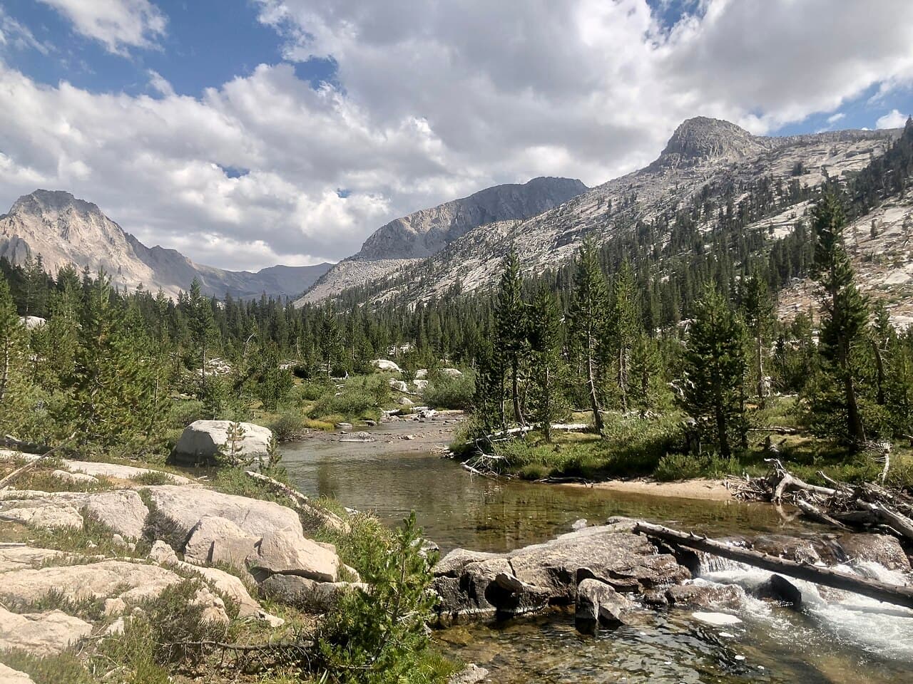
- Bubbs Creek cascading beside the trail
- East Vidette from the meadow
Bubbs Creek rules, gear and safety
Gear checklist
Required- A park-allowed portable animal-resistant food storage container, required May 1 to October 31 in this drainage
- Water treatment
- Trekking poles for the steep first four miles
- Warm layers for camps at and above Vidette Meadow
Rules & regulations
- 01The first allowable camping is 4 miles from Roads End at the Sphinx Creek crossing
- 02This permit does not allow you to start the Rae Lakes Loop in the clockwise direction
- 03Park-allowed portable animal-resistant food storage containers are required May 1 to October 31 in the Bubbs and Woods Creek drainages
- 04Use designated sites only in Lower Paradise Valley
- 05No camping within 0.25 miles of Bullfrog Lake
- 06Two-night camping limit for Paradise Valley, Charlotte Lake and Kearsarge Lakes
- 07Maximum group size is 15
- 08Permits must be physically picked up and validated at a wilderness office
Hazards & considerations
- A steep, hot, exposed first four miles out of the canyon
- Bears throughout the Bubbs and Woods Creek drainages, which is why containers are mandatory
- Afternoon thunderstorms once you are above Junction Meadow
- Creek crossings running high during spring melt
Safety & planning
Emergency Info
Emergency contacts, ranger station locations, and satellite communicator tips for Bubbs Creek.
Food Storage
Bear canister requirements, approved container lists, and rental locations for this permit.
Gear Checklist: Required and recommended gear for Bubbs Creek · Shuttle Services: Trailhead transportation options · Guide Services: Experienced wilderness guides
Some links may be affiliate links. Purchases support PermitSnag at no extra cost to you.
Bubbs Creek FAQ
How many people per day get a Bubbs Creek wilderness permit?
NPS publishes a 25-person daily quota for the Bubbs Creek entry point, of which 20 are reservable.
Can I hike the Rae Lakes Loop clockwise on a Bubbs Creek permit?
No. NPS states this permit does not allow you to start the Rae Lakes Loop in the clockwise direction. To do that you must select the Woods Creek entry point.
Where is the first place I can camp on the Bubbs Creek trail?
NPS puts the first allowable camping 4 miles from Roads End at the Sphinx Creek crossing.
Do I need a bear canister for a Bubbs Creek wilderness permit?
Yes. NPS requires park-allowed portable animal-resistant food storage containers from May 1 to October 31 in the Bubbs and Woods Creek drainages.
Bubbs Creek trail conditions and trip reports
Trail Conditions
No active conditions reported
Sign in to report trail conditions.
Questions
No questions yet
Be the first to ask about Bubbs Creek.
Trip Reports
Write ReportAlternatives to a Bubbs Creek permit
- Similar ExperiencePermit required
Cedar Grove - Woods Creek
The clockwise start on the Rae Lakes Loop, up Paradise Valley.
Tradeoffs
Same 25-person quota and a gentler grade, with the first camping 6.5 miles in.
- Same AreaPermit required
Rae Lakes Loop
The loop itself, checked across both Roads End entry points.
Tradeoffs
One alert covering both directions rather than a single entry point.
- Same AreaPermit required
Cedar Grove - Copper Creek
The other Roads End climb, north toward Granite Basin and the Monarch Divide.
Tradeoffs
A brutally steep start, but far fewer people than the loop.
Where to stay near Bubbs Creek
- Potwisha CampgroundSequoia & Kings Canyon National Parks
- Buckeye Flat CampgroundSequoia & Kings Canyon National Parks
- Atwell Mill CampgroundSequoia & Kings Canyon National Parks
- All California campgrounds
Trip planning
Articles that plan a trip around this permit.
Plan the full trip, not just the permit
Build your full itinerary start to finish
Add your dates and get a day-by-day plan: what needs a permit, what gear to bring, and one link to share with your whole group to coordinate every step.
No permit needed to start
One tick helps us more than you’d think
Google lets you pick the sites it highlights for you. Add PermitSnag and our permit pages get marked as one of yours in AI Overviews and AI Mode.
Takes less than a minute.