Lottery10/10
Mt. Whitney Day
Climb the highest peak in the contiguous United States (14,505 ft). The main Whi...
View Mount Whitney Day Hike Permit permit details and availabilityPermitSnag checks Recreation.gov every 2-3 minutes. When a cancellation posts, we send an alert so you can book before the spot is gone.

Sequoia & Kings Canyon National Parks
One of California's premier backpacking routes—a 41-mile loop through pristine alpine lakes, granite canyons, and the heart of the High Sierra.
“Circle through the crown jewels of Kings Canyon—from thundering waterfalls to glacial lakes reflecting the jagged peaks of the Sierra crest.”
Be notified instantly when Rae Lakes permits become available due to cancellations.
Be notified instantly when Rae Lakes permits become available due to cancellations.
Mid-July through September. Early July may have snow on Glen Pass and dangerous creek crossings. Late September offers fewer crowds and golden light but shorter days and cold nights.
Sign up at Recreation.gov if you don't have an account. Have your payment info ready.
Permits typically release on a rolling basis. Check the specific release time for your desired dates.
Log in a few minutes early. Have your dates, group size, and payment ready to go.
If your dates are sold out, people cancel all the time. Set up PermitSnag alerts to catch openings instantly.
Snow-free above 10,000 ft by mid-July most years. Afternoon thunderstorms common.
Fitness and endurance required
Climbing, scrambling, or specialized skills
Steep dropoffs and fall potential
Route finding and trail clarity
Difficulty of bailing out mid-route
Fit backpackers comfortable with multi-day trips and moderate altitude. Prior High Sierra experience helpful but not required.
Should have completed at least one multi-day backpacking trip with 20+ miles and 4,000+ feet of gain.
First-time backpackers or those who struggle at elevation above 10,000 feet.
The Rae Lakes Loop is a 41.4-mile backpacking circuit in Kings Canyon National Park, circumnavigating the Kings-Kern Divide through some of the most spectacular alpine terrain in the Sierra Nevada. The loop climbs from 5,035 feet at Roads End to 11,978 feet at Glen Pass, passing through Paradise Valley, the Rae Lakes basin, and Vidette Meadow.
Most hikers complete the loop in 3-5 days, though strong hikers have done it in 2 days. The route shares portions with the John Muir Trail and Pacific Crest Trail.
The Rae Lakes Loop is widely considered California's finest backpacking circuit outside the JMT. It traverses some of the most spectacular alpine terrain in North America, crossing Glen Pass at nearly 12,000 feet and passing through the stunning Rae Lakes basin—a string of turquoise gems set against granite towers. For many Sierra hikers, completing the loop is a rite of passage.
From Roads End, the loop can be hiked in either direction. Most choose clockwise via Woods Creek for more gradual elevation gain.
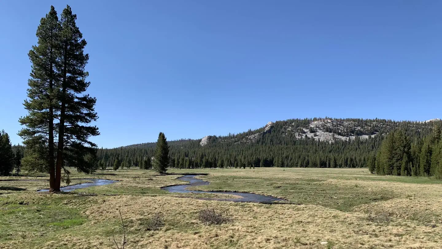
The first miles follow the South Fork Kings River, passing thundering Mist Falls at mile 3.9—a preview of Sierra splendor. Paradise Valley opens beyond, a wide meadow where the river slows and bears patrol the willows. By mile 15, you've climbed to the Woods Creek crossing—the swaying suspension bridge marking your entry into the high country.
Dollar Lake appears first, then Arrowhead, then the main event: the Rae Lakes themselves, strung like pearls at 10,500 feet. The climb to Glen Pass begins in earnest—sixty switchbacks of rocky trail culminating at 11,978 feet, the highest point you can reach on a maintained trail in Kings Canyon.
The descent through Vidette Meadow and down Bubbs Creek returns you to the realm of waterfalls and towering walls, completing one of America's great backpacking loops.
The first glimpse of the Rae Lakes basin stops you in your tracks. Three lakes stair-step up a glacial cirque, their impossible blue waters framed by the Painted Lady and Fin Dome. You've earned this view—the long climb through Paradise Valley, the crossing of roaring Woods Creek, the relentless switchbacks to Dollar Lake. And tomorrow, Glen Pass awaits—the highest point on the loop, where the entire Kings Canyon spreads below you like a topographic map come to life.
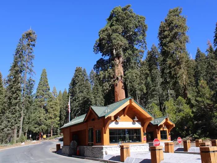
The only trailhead for the Rae Lakes Loop, located at the end of CA-180 in Cedar Grove.
Paved lot with ample parking. Fills on summer weekends. Bear canister rentals available at the wilderness permit station.
From Fresno, take CA-180 east approximately 85 miles. Road closes in winter (typically November-April).
Cedar Grove Village has a small store, restaurant, and lodging. Grant Grove (30 miles) has more services.
Required and recommended gear for Rae Lakes
Trailhead transportation options
Browse all shuttlesExperienced wilderness guides
Browse all guidesSome links may be affiliate links. Purchases support PermitSnag at no extra cost to you.
12,453 permits and 8,294 campsites secured by PermitSnag users
Rae Lakes permits use a reservation system. PermitSnag sends lottery open, deadline, and results reminders; you can also enable cancellation alerts if spots open later.
Check with the managing agency for current season dates. Weekdays generally have better availability than weekends.
This permit has a demand score of 8/10, making it highly competitive. We recommend having backup dates and using PermitSnag's cancellation alerts.
Cancellations happen daily. Set up alerts with PermitSnag to get notified the moment a spot opens up. We check availability every 2-3 minutes, 24/7.
Sunrise at the Rae Lakes with Fin Dome and Painted Lady reflecting in still water is the loop's signature shot. Arrive at the lakes early for mirror-calm conditions.
Early morning light illuminates the east face of the peaks above the lakes. Glen Pass views are best in late morning when the sun lights the entire Kings Canyon basin.
The lakes are busiest July-August. September offers golden light, fewer crowds, and reliable conditions. Weekday starts reduce crowding at the one-night-limit campsites.
Consider these alternatives if your preferred dates aren't available.
Hike to Rae Lakes and back without crossing Glen Pass. Covers the loop's highlight without the most strenuous section.
Misses Glen Pass views and Bubbs Creek section, but reduces total mileage and difficulty.
Hike the JMT through the Rae Lakes section as a point-to-point traverse, exiting via Kearsarge Pass.
Requires shuttle logistics but covers additional spectacular JMT terrain.
Similar alpine scenery accessible from the eastern Sierra via Bishop Pass. Less crowded than Rae Lakes.
Different approach but comparable High Sierra beauty with easier permit availability.
Nearby campgrounds to complete your Rae Lakes trip
Permit Directory
Find permits for day hikes, overnight backpacking, thru-hikes, canyoneering, and river trips across federal and state lands.
Day-use, overnight, and wilderness permits at America's crown jewels
Sierra Nevada, Lost Coast, and backcountry access
Red rock canyons, slot canyon permits, and desert wilderness
USFS wilderness areas with quota systems
Multi-day point-to-point traverses and epic long-distance trails
Multi-day rafting and river access permits
Backcountry camping and trail permits
High-altitude summit permits and technical climbing routes