Skip to content
Hawaiʻi Volcanoes Backcountry Permit permit area in Hawaiʻi Volcanoes National Park - backcountry hiking destination
Booked one camp per night, in order

Hawaiʻi Volcanoes Backcountry Permit

Hawaiʻi Volcanoes National Park · Hawaii

Required year round for every backcountry night in the park. Pick the area you want, from the coastal shelters to the Mauna Loa cabins, and the quota is 16 people a night per area.

Get an alert when a night opens on your Hawaiʻi Volcanoes dates.

Get alerts for your Hawaiʻi Volcanoes nights

A Hawaiʻi Volcanoes reservation is a sequence of nights, and each night books a camp.

Give us your trip window and we check every night of it across all camps on this permit, then tell you the moment nights open.

Cover the whole trip, plus any spare days you could shift onto. A wider window catches more openings.

The window above is how much time you have to work with. This is how many nights the trip itself takes. Leave it blank and we'll check every night in the window. We alert you when 2 or more nights in a row open.

Party

When it opens

90 days
First come, first served from 90 days before your entry date75% of the quota for each locationYou book on Recreation.gov.
1 week
First come, first served from seven days before your entry datethe remaining 25% of the quota for each locationYou book on Recreation.gov.

Source: recreation.gov

70% of the openings our scanner caught on Hawaiʻi Volcanoes were gone within 10 minutes.

Hawaiʻi Volcanoes reservation dates

route distance, out and back
8mi
daily quota
16people
max group size
12people

How to get a Hawaiʻi Volcanoes permit

As of September 2026, Hawaiʻi Volcanoes in Hawaiʻi Volcanoes National Park, Hawaii requires a permit issued via reservation. Hawaiʻi Volcanoes rates 6/10 on PermitSnag's demand index. Cancelled Hawaiʻi Volcanoes permits are re-released on the booking system, and PermitSnag alerts you the moment one opens. The Hawaiʻi Volcanoes route covers 8 miles, rated strenuous.

Type
Backpacking
Location
Island of Hawaiʻi, HI
  1. Step 1: Create a Recreation.gov account

    Sign up at Recreation.gov if you don't have an account. Have your payment info ready.

  2. Step 2: Know the release schedule

    Permits release on a rolling basis. Check the release time for your dates.

  3. Step 3: Be ready when permits drop

    Log in a few minutes early. Have your dates, group size, and payment ready to go.

  4. Step 4: Monitor for cancellations

    If your dates are sold out, people cancel all the time. Set up PermitSnag alerts to catch openings instantly.

Hawaiʻi Volcanoes pro tips

  1. A quarter of each area's quota is held back for in-person pickup starting 7 days out. If the online window is full, that is your second shot.
  2. Ask the rangers about catchment tank levels when you pick up the permit. That is the only current read on backcountry water.
  3. Halapē books first. Keauhou and ʻĀpua Point are the same coast and the same walk.
  4. Report out when you finish. In a park that erupts, the check-out is how rangers know who is still out there.

More on Hawaiʻi Volcanoes: Live availability activityWhen Hawaiʻi Volcanoes permits open up

How much a Hawaiʻi Volcanoes permit costs

Hawaiʻi Volcanoes permit fee: $10 per permit.

The Hawaiʻi Volcanoes hike

Distance
8 miles
Route Type
Out & Back
Duration
2-3 days
Difficulty
Strenuous
High Point
2,282 ft

Hawaiʻi Volcanoes elevation profile

Hilina Pali Overlook Trailhead to Halapē, one way
Landmark 1 of 9Point of Interest

Backcountry Office

Off Crater Rim Drive East near the Kīlauea Visitor Center. Permits are picked up here.

Elevation
3,939 ft
From start
+1,657 ft
  1. Off Crater Rim Drive East near the Kīlauea Visitor Center. Permits are picked up here.

  2. Shortest approach to Halapē at 8.0 miles. The pali drops off the edge here.

  3. Coastal site with a three-walled shelter and a roof catchment tank.

  4. Coconut grove and tide pools on the black coast, with a shelter and catchment tank.

  5. Coastal shelter site east of Halapē on the Puna Coast Trail.

  6. The easternmost coastal site, reached from the Puna Coast Trail.

  7. Rift zone site in the Nāpau Wilderness, reached from the Mauna Ulu parking area.

  8. Mauna Loa Trail cabin partway up the mountain. Bunks are first come first served on arrival.

  9. Summit-area cabin on a 13,677 foot volcano, subject to severe weather closures.

Walk 8 miles down a lava desert with no shade at all and finish at a coconut grove above a tide pool, in a park where the ground itself is still being built.

About this permit

Hawaiʻi Volcanoes requires a backcountry permit year round for every overnight, and day hikers do not need one. The quota for each area is 16 visitors per night, raised by the occupancy of the cabin where there is one. A single permit covers up to 12 people.

Permits can be reserved up to 90 days in advance, with new dates released daily at 7:00 am Hawaii time. Seventy-five percent of each area's quota goes online 90 days out and the remaining 25 percent is held for in-person pickup starting 7 days before entry. You pick the permit up at the backcountry office and must carry a printed copy.

The route

The coastal sites are the heart of this permit. Halapē is reached in 8.0 miles from Hilina Pali Overlook, 8.5 or 9.2 miles from the Mau Loa o Maunaulu trailhead, or 11.3 miles from Puʻuloa, with a maximum elevation change between trailhead and campsite of 3,000 feet. Keauhou, ʻĀpua Point and Kaʻaha spread along the same coast.

Kaʻaha, Halapē and Keauhou have three-walled primitive shelters with roof catchment tanks, which is the only water out there and is not always in them. Everyone treats what they take.

Inland, Nāpau sits in the rift zone below Puʻu ʻŌʻō. Up high, the Mauna Loa Cabin and Puʻuʻulaʻula (Red Hill) Cabin sit on the flanks of a 13,677 foot volcano, where bunks go first come first served on arrival and severe weather closures are routine.

Why it matters

This is the only backcountry in the National Park System that gets rewritten by eruptions. Sites open and close as flows move, the permit office wants to know who is out there in case of an eruption, tsunami or earthquake, and the shelters at Halapē and Keauhou stand where the 1975 earthquake dropped the coast into the sea.

The feeling

The Kaʻū Desert is black on black, hot enough to feel through boot soles, and completely without a tree. You walk for hours and the only landmarks are ahu, little stacked rock cairns. Then the pali steps down, the trade wind arrives, and Halapē appears below you as a smear of green on a black shore.
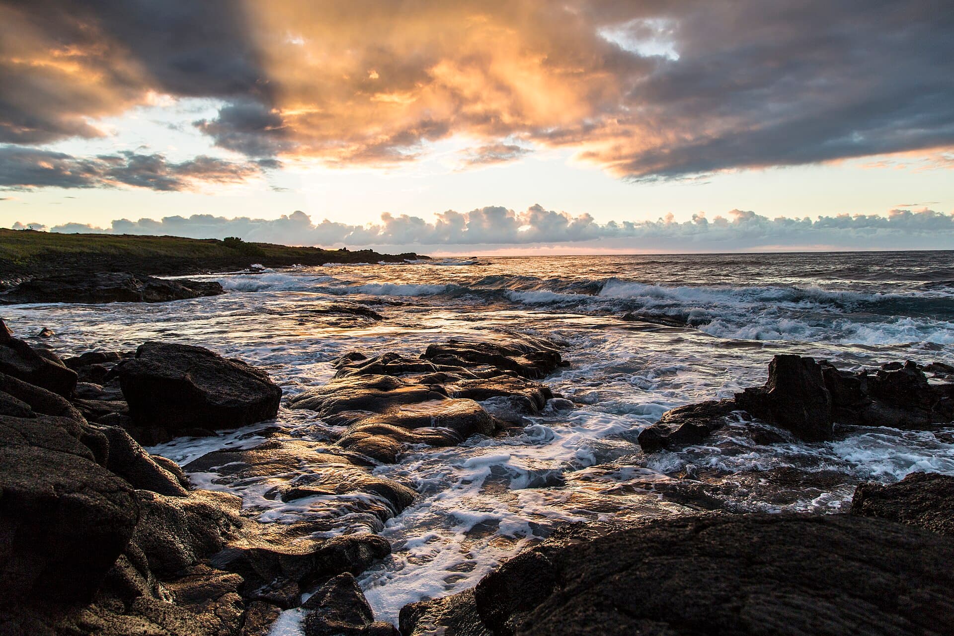
Hawaiʻi Volcanoes hike highlights

  1. A quota of 16 visitors per night per area, plus cabin occupancy where a cabin exists
  2. Three-walled primitive shelters at Kaʻaha, Halapē and Keauhou with roof catchment tanks
  3. No streams anywhere in the coastal area, and catchment tanks that are sometimes empty
  4. Zero shade on the coastal approaches and daytime temperatures into the high 90s
  5. Sites that open and close as eruptions change the ground

How hard the Hawaiʻi Volcanoes hike is

  • Physical DemandFitness and endurance required4/5
  • Technical SkillClimbing, scrambling, or specialized skills2/5
  • Exposure RiskSteep dropoffs and fall potential2/5
  • NavigationRoute finding and trail clarity3/5
  • CommitmentDifficulty of bailing out mid-route4/5

Best for: Backpackers who can carry two days of water across an unshaded lava desert and are comfortable following ahu instead of tread.

Recommended experience: A prior desert or lava-field hike. The Park Service asks you to be honest about whether you are fit for the hike you are booking.

Not recommended for: Anyone counting on finding water on route, or anyone attempting the coast in the middle of a summer day.

Trailhead information

Hilina Pali Overlook

Primary

The shortest approach to Halapē at 8.0 miles, straight off the edge of the pali.

  • No restrooms
  • No water
  • No Service

Before you rely on this water

No water at the trailhead and none on route. The only backcountry water is roof catchment at Kaʻaha, Halapē and Keauhou, it is not always available, and it must be treated.

Parking

Small overlook lot at the end of Hilina Pali Road.

Getting There

Hilina Pali Road off Chain of Craters Road. Narrow and slow but paved.

Nearest Services

Volcano village, about 40 minutes back up the road.

Trailhead information

Puna Coast Trailhead (Puʻu Loa)

Alternate

Coastal approach at the bottom of Chain of Craters Road. The longest way in to Halapē at 11.3 miles.

  • No restrooms
  • No water
  • No Service

Before you rely on this water

Nothing here. Carry everything from the summit area.

Parking

Roadside parking at the Puʻu Loa petroglyphs pullout.

Getting There

End of Chain of Craters Road, paved the whole way.

Nearest Services

Volcano village.

Trailhead information

Mauna Loa Trailhead (Mauna Loa Lookout)

Alternate

6,662 ft elevation

Start of the Mauna Loa Trail to Red Hill and the summit cabin.

  • Restrooms
  • No water
  • No Service

Before you rely on this water

No water at the trailhead. Cabin catchment tanks are the only source and can be empty.

Parking

Lot at the Mauna Loa Lookout at the end of Mauna Loa Road.

Getting There

Eleven miles of narrow one-lane road with pullouts, off Highway 11.

Nearest Services

Volcano village.

When to hike Hawaiʻi Volcanoes

Best time to visit

The permit office is open daily year round. Coastal trips are most comfortable in the cooler months from November through March, when the lava desert is survivable in the middle of the day.

Peak
December through March
Shoulder
April and November
  • Spring

    Warming with steady trade winds. Good conditions on both the coast and the mountain.

    Crowd level · moderate

    • Advantage: Reliable trades
    • Advantage: Long dry windows
    • Challenge: Coastal heat building
    • Challenge: Catchment levels dropping
  • Summer

    Hot and dry on the coast. High 90s with no shade.

    Crowd level · moderate

    • Advantage: Best weather for the Mauna Loa cabins
    • Advantage: Long daylight
    • Challenge: Dangerous coastal heat
    • Challenge: Catchment tanks often empty
    • Challenge: Sun exposure all day
  • Fall

    Heat easing off, trades steady, the coast getting pleasant again by November.

    Crowd level · low

    • Advantage: Quieter trails
    • Advantage: Improving temperatures
    • Challenge: Still hot into October
    • Challenge: Water still scarce
  • Winter

    Cooler and wetter at the summit, and the only time the coastal desert is comfortable midday.

    Crowd level · high

    • Advantage: Coastal heat is manageable
    • Advantage: Catchment tanks are more likely to have water
    • Challenge: Rain and wind at the summit
    • Challenge: Mauna Loa weather closures
    • Challenge: Peak visitation on the island

Weather Forecast

Trailhead (0 ft)

⚠️

Backcountry Tips

  • Today: 92% chance of precipitation. Pack rain gear.
  • Tomorrow: 99% chance of precipitation. Pack rain gear.
  • Day 3: 94% chance of precipitation. Pack rain gear.

Today

🌧️

68°

57°

92%

Wed

🌧️

67°

60°

99%

Thu

🌧️

67°

61°

94%

Fri

🌧️

67°

59°

81%

Sat

🌧️

69°

60°

88%

Sun

☁️

69°

60°

43%

Mon

🌧️

67°

59°

57%

View full NWS forecast →Mountain weather changes rapidly. This forecast is a guide—always be prepared for worse conditions.

Hawaiʻi Volcanoes photography guide

Golden Hour

Sunrise at Halapē over the tide pools, with the coconut palms in silhouette against the black lava.

Best Light

Shoot the Kaʻū Desert early. By 10am the light is flat and the heat is punishing.

Beat the Crowds

Halapē fills first. Keauhou and ʻĀpua Point are on the same coast with the same view and far fewer permits taken.

Classic Shots

  1. Halapē coconut grove from the pali above
  2. Tide pools filling on the black shore at first light
  3. Ahu cairns marking the route across the lava desert
  4. The Mauna Loa summit caldera from the cabin trail

Hawaiʻi Volcanoes rules, gear and safety

Gear checklist

Required
  • All your water for the trip, since catchment tanks are not always available
  • Water treatment for anything you do take from a catchment tank
  • Sun protection that works with no shade at all
  • A printed copy of your permit, carried at all times
  • Sturdy boots. The lava eats trail runners

Recommended gear

  • Gloves for lava scrambling
  • Extra layers for the Mauna Loa cabins, where it is 12 to 15 degrees cooler than sea level at the 4,000 foot Kīlauea summit and far colder higher up
  • Satellite messenger, since there is no coverage on the coast
  • Sleeping pad even at the shelters, which have concrete floors

Rules & regulations

  1. 01A backcountry permit is required year round for all overnight stays. Day use needs no permit
  2. 02The quota is 16 visitors per night per area, increased by the occupancy limit of each cabin
  3. 03One permit covers a maximum of 12 people
  4. 04Three consecutive nights maximum in one site, and no more than seven consecutive nights on the whole permit
  5. 05No person or group may camp anywhere in the park for more than 30 days per calendar year
  6. 06Permits are not transferable. Only the listed group leader or the named alternate may be issued the permit
  7. 07Cabin bunks are first come first served on arrival and cannot be reserved
  8. 08Report out at the Backcountry Office or call 808-985-6178 when you finish

Hazards & considerations

  • Daytime temperatures on the coast soar into the high 90s with no trees for relief
  • Earthquakes can produce large rock falls. Avoid potential rock fall areas
  • Centipedes, scorpions and black widow spiders are common in stone walls and rocky areas
  • Sharks are sometimes seen in coastal waters
  • Volcanic gas and sudden eruption closures
  • Mauna Loa sites are subject to severe weather closures

Safety & planning

Emergency Info

Emergency contacts, ranger station locations, and satellite communicator tips for Hawaiʻi Volcanoes.

Food Storage

Bear canister requirements, approved container lists, and rental locations for this permit.

Gear Checklist: Required and recommended gear for Hawaiʻi Volcanoes · Shuttle Services: Trailhead transportation options · Guide Services: Experienced wilderness guides

Some links may be affiliate links. Purchases support PermitSnag at no extra cost to you.

Hawaiʻi Volcanoes FAQ

How do I get a Hawaiʻi Volcanoes backcountry permit?

Reserve it on Recreation.gov permit 4675341 up to 90 days ahead, with new dates released daily at 7:00 am Hawaii time. Pick the permit up at the backcountry office starting 7 days before your entry date, and carry the printed copy.

How many people can be on a Hawaiʻi Volcanoes backcountry permit?

Up to 12. The separate area quota is 16 visitors per night, raised by the occupancy of each cabin where one exists.

Is there water in the Hawaiʻi Volcanoes backcountry?

Only roof catchment tanks at the three-walled shelters at Kaʻaha, Halapē and Keauhou, and at the cabins. The Park Service says water is not always available and there are no streams in the area. Treat anything you take.

How much does a Hawaiʻi Volcanoes backcountry permit cost?

$10 per permit. Reserved and walk-up permits cost the same. The park entrance fee is separate.

Can I reserve a bunk in the Mauna Loa cabin with a backcountry permit?

No. Recreation.gov states bunks are available on arrival at the cabin on a first come first served basis. The permit reserves your place in the area quota, not a specific bunk.

Hawaiʻi Volcanoes trail conditions and trip reports

Trail Conditions

No active conditions reported

Sign in to report trail conditions.

Questions

No questions yet

Be the first to ask about Hawaiʻi Volcanoes.

Trip Reports

Write Report

No trip reports yet

Be the first to share your experience at Hawaiʻi Volcanoes.

Write the First Report

Alternatives to a Hawaiʻi Volcanoes permit

  • Similar ExperiencePermit required

    Everglades wilderness camping

    The other coastal wilderness permit where every drop of water is carried and the campsites are fixed structures.

    Tradeoffs

    You paddle instead of walk, and navigation is by chart rather than by cairn.

  • Similar ExperiencePermit required

    Death Valley Cottonwood-Marble loop

    Another unshaded desert route where the water sources are unreliable and the season is winter.

    Tradeoffs

    Cooler nights and actual springs, but a 4x4 approach.

  • Easier AlternativePermit required

    Guadalupe Mountains wilderness

    Designated desert mountain campgrounds where the park states plainly that there is no water.

    Tradeoffs

    Shorter trips and a much easier drive, but 2,000 feet of climbing to any campground.

Plan the full trip, not just the permit

Build your full itinerary start to finish

Add your dates and get a day-by-day plan: what needs a permit, what gear to bring, and one link to share with your whole group to coordinate every step.

Plan a trip here

No permit needed to start

One tick helps us more than you’d think

Google lets you pick the sites it highlights for you. Add PermitSnag and our permit pages get marked as one of yours in AI Overviews and AI Mode.

Add PermitSnag in Google

Takes less than a minute.