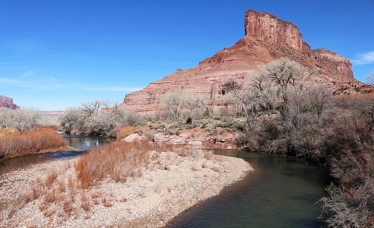
Dolores River (Gateway to Dewey Bridge) Permit
Colorado Plateau Rivers · Colorado
32 miles from Gateway, Colorado to Dewey Bridge, Utah. Unlimited permits, but a runoff season so short that most years it barely happens.
Get an alert when a Lower Dolores launch date opens.
70% of the openings our scanner caught on Lower Dolores were gone within 10 minutes.
Lower Dolores reservation dates
- route distance, point to point
- 32mi
- max group size
- 25people
How to get a Lower Dolores permit
As of September 2026, Lower Dolores in Colorado Plateau Rivers, Colorado requires a permit issued via reservation. Lower Dolores rates 4/10 on PermitSnag's demand index. Cancelled Lower Dolores permits are re-released on the booking system, and PermitSnag alerts you the moment one opens. The Lower Dolores route covers 32 miles, rated strenuous.
- Type
- River Access
- Location
- Colorado Plateau, CO
Step 1: Create a Recreation.gov account
Sign up at Recreation.gov if you don't have an account. Have your payment info ready.
Step 2: Know the release schedule
Permits release on a rolling basis. Check the release time for your dates.
Step 3: Be ready when permits drop
Log in a few minutes early. Have your dates, group size, and payment ready to go.
Step 4: Monitor for cancellations
If your dates are sold out, people cancel all the time. Set up PermitSnag alerts to catch openings instantly.
More on Lower Dolores: Live availability activityWhen Lower Dolores permits open up
How much a Lower Dolores permit costs
Lower Dolores permit fee: $6 non-refundable reservation fee.
The Lower Dolores trip
- Distance
- 32 miles
- Route Type
- Point to Point
- Duration
- 2-3 days
- Difficulty
- Strenuous
About this permit
The permit itself is not the hard part on the Lower Dolores. BLM issues an unlimited number of them and opens the whole year on January 1. The hard part is water. BLM's own words are that the Lower Dolores has a very short, erratic and often non-existent boating season, with flows typically peaking between late April and early May.
The run starts just upstream of the Dolores River Bridge in Gateway, Colorado and takes out 32 miles downstream on the Colorado River at Dewey Bridge. The crux is Stateline Rapid, a Class IV rock garden about a mile long that starts at the Colorado-Utah border and that BLM says needs scouting at all water levels.
Because permits are unlimited, watch the gauge rather than the calendar. BLM lists suggested minimums of 200 cfs for canoes, packrafts, kayaks and inflatable kayaks, 800 cfs for rafts under 14 feet, and 1,000 cfs for rafts larger than 14 feet.
Lower Dolores trip highlights
- Technical rapids, side-canyon hiking and few other boaters
- Stateline Rapid, a mile-long Class IV rock garden at the state line
- A season that in many years does not open at all
- No potable water, and silty river water that is hard to filter
- A take-out on the Colorado River at Dewey Bridge, not on the Dolores
How hard the Lower Dolores trip is
- Physical DemandFitness and endurance required5/5
- Technical SkillClimbing, scrambling, or specialized skills2/5
- NavigationRoute finding and trail clarity2/5
- CommitmentDifficulty of bailing out mid-route4/5
Best for: Experienced hikers with excellent fitness and relevant technical skills.
Recommended experience: Multi-day backpacking or river experience recommended.
When to float Lower Dolores
Best time to visit
BLM says flows typically peak between late April and early May in high water years. Check the gauge against the craft-specific minimums before you commit to a shuttle.
Weather Forecast
Trailhead (5,000 ft)
Today
67°
57°
43%
Wed
80°
59°
Thu
83°
56°
Fri
83°
62°
Sat
85°
63°
Sun
85°
64°
Mon
82°
64°
Lower Dolores rules, gear and safety
Gear checklist
Required- All drinking water, at least a gallon per person per day
- Human waste carry-out system
- Printed permit
Rules & regulations
- 01Permits are unlimited and the whole year opens on January 1
- 02Group size is 1 to 25
- 03Permit holders must be 18 or older
- 04One person may hold up to three permits at a time
- 05The alternate trip leader must be entered at booking and cannot be changed afterward
- 06A printed permit must be carried on the trip, available to print 14 days before launch
- 07Pets are allowed on the Dolores
- 08Private and non-commercial use only
Hazards & considerations
- Stateline Rapid, Class IV, requires scouting at all water levels
- Flows that can vanish mid-trip on an unregulated desert river
- No potable water anywhere on the run
- Search and rescue handled by Grand County, with long response times
Safety & planning
Emergency Info
Emergency contacts, ranger station locations, and satellite communicator tips for Lower Dolores.
Food Storage
Bear canister requirements, approved container lists, and rental locations for this permit.
Gear Checklist: Required and recommended gear for Lower Dolores · Shuttle Services: Trailhead transportation options · Guide Services: Experienced wilderness guides
Some links may be affiliate links. Purchases support PermitSnag at no extra cost to you.
Lower Dolores FAQ
Is the Dolores River permit hard to get?
No. BLM states there is no limit on the number of permits issued and releases the entire year on January 1. Water is the constraint, not the permit.
What flow do I need for a Dolores River trip?
BLM suggests minimums of 200 cfs for canoes, packrafts, kayaks and inflatable kayaks, 800 cfs for rafts under 14 feet, and 1,000 cfs for rafts larger than 14 feet.
How long is the Lower Dolores River permit section?
32 miles, from the put-in just above the Dolores River Bridge in Gateway, Colorado to the Dewey Bridge Recreation Site on the Colorado River in Utah.
Lower Dolores river conditions and trip reports
Trail Conditions
No active conditions reported
Sign in to report trail conditions.
Questions
No questions yet
Be the first to ask about Lower Dolores.
Trip Reports
Write ReportAlternatives to a Lower Dolores permit
- Same AreaPermit required
Westwater Canyon
Dam-backed Colorado River flows and a reliable season, 17 miles below the Dolores confluence area.
Tradeoffs
Far more reliable water. Far harder permit, at five launches a day.
Where to stay near Lower Dolores
- Dewey Bridge Group SitesMoab Field Office (BLM)
- Hittle Bottom Group SiteMoab Field Office (BLM)
- Lower Onion Creek Group SitesMoab Field Office (BLM)
- All Colorado campgrounds
Plan the full trip, not just the permit
Build your full itinerary start to finish
Add your dates and get a day-by-day plan: what needs a permit, what gear to bring, and one link to share with your whole group to coordinate every step.
No permit needed to start
One tick helps us more than you’d think
Google lets you pick the sites it highlights for you. Add PermitSnag and our permit pages get marked as one of yours in AI Overviews and AI Mode.
Takes less than a minute.