Skip to content
Trans-Catalina Trail Permit wilderness permit area in Catalina Island Conservancy - backcountry hiking destination
ReservationThru-Hike

Trans-Catalina Trail Permit

Catalina Island Conservancy · California

A rugged 38.5-mile traverse across Santa Catalina Island, from the harbor town of Avalon to the remote western beaches, with wild bison, endemic foxes, and stunning Pacific views.

Other permits in Catalina Island Conservancy we can check

Little Harbor · Parsons Landing · Hermit Gulch

“Traverse an island wilderness 22 miles off the California coast, where American bison roam the hills and the Pacific stretches to the horizon in every direction.”

Plan your Catalina Island Conservancy trip here, then get your permit from the agency.

Plan your trip

How to get Trans-Catalina

Book the Trans-Catalina Trail one campground a night: the Catalina Island Company's booking page puts each night's campground in one cart. We check all five: Hermit Gulch, Blackjack, Little Harbor, Two Harbors and Parsons Landing. Set an alert on the nights you need, then book each one on their camping page.

Official permit page

Planning another trip? See the permits we alert on.

Trans-Catalina reservation dates

route distance, point to point
38.5mi
max group size
25people

Trans-Catalina elevation profile

Avalon to Starlight Beach
Landmark

Avalon

Starting point. Harbor town with ferry terminal, restaurants, and last full services.

Mile 0 of 38.5
0 Avalon38.5 Starlight Beach
Mile
0
Elevation
10 ft

Trans-Catalina landmarks

How to get a Trans-Catalina permit

As of September 2026, Trans-Catalina in Catalina Island Conservancy, California requires a permit issued via reservation. Trans-Catalina is a high-demand permit, rating 8/10 on PermitSnag's demand index. The Trans-Catalina route covers 38.5 miles, rated strenuous.

Type
Thru-Hike
Location
Channel Islands, CA
  1. Step 1: Create a VisitCatalinaIsland.com account

    Sign up at VisitCatalinaIsland.com if you don't have an account. Have your payment info ready.

  2. Step 2: Know the release schedule

    Permits release on a rolling basis. Check the release time for your dates.

  3. Step 3: Be ready when permits drop

    Log in a few minutes early. Have your dates, group size, and payment ready to go.

More on Trans-Catalina: Live availability activityWhen Trans-Catalina permits open upTrans-Catalina Trail permit itineraryDo I need a Trans-Catalina Trail permit?Agency and concessionaire portals permit cancellations

How much a Trans-Catalina permit costs

Trans-Catalina permit fee: $30-45/night per campground.

The Trans-Catalina hike

Distance
38.5 miles
Route Type
Point to Point
Duration
3-5 days
Difficulty
Strenuous
High Point
1,760 ft

Traverse an island wilderness 22 miles off the California coast, where American bison roam the hills and the Pacific stretches to the horizon in every direction.

About this permit

The Trans-Catalina Trail (TCT) is a 38.5-mile thru-hike across Santa Catalina Island, approximately 22 miles off the coast of Southern California. Despite the island being only 22 miles long, the trail's winding path and significant elevation changes accumulate nearly 8,500 feet of climbing.

The trail passes through five designated campgrounds and is typically completed in 3-5 days. Dispersed camping is prohibited: you must stay in campgrounds, and reservations serve as your hiking permit.

The route

From Avalon, the trail climbs steeply out of town, 1,500 feet of gain in the first few miles. The initial stretch to Black Jack campground follows ridgelines with panoramic Pacific views, passing through eucalyptus groves and chaparral.

Day two brings you to the 'Airport in the Sky', an actual airport perched on a mesa at 1,602 feet, famous for its DC-3 Grill and legendary bison burgers. From here, the trail descends sharply to Little Harbor, a crescent beach on the island's wild backside.

The ridge traverse from Little Harbor to Two Harbors offers some of the trail's most dramatic scenery, with the narrow isthmus visible ahead. Two Harbors provides the last resupply before the final push.

The stretch to Parsons Landing is the trail's most challenging: a steep climb over 'Fenceline Road' followed by the descent to a primitive beach camp with no running water. Most hikers then follow the relatively flat West End Road back to Two Harbors to catch the ferry home.

Why it matters

Catalina Island has a fascinating history: used as a movie set, a military base, and a ranching operation where bison were introduced in the 1920s for a film shoot and never left. Today, the Catalina Island Conservancy protects 88% of the island as wilderness. The Trans-Catalina Trail offers a unique coastal backpacking experience just an hour's ferry ride from Los Angeles, combining dramatic ocean scenery with surprising wildlife encounters.

The feeling

The ferry drops you in Avalon, a charming harbor town with golf carts and ice cream shops. Within hours, you've climbed into an entirely different world: arid hillsides dotted with grazing bison, endemic Catalina foxes trotting along the trail, and views that stretch across the Pacific to the mainland's hazy skyline. At night, you camp on beaches lit only by stars and bioluminescent waves. By the time you reach Parsons Landing, you've crossed an island that feels far more remote than its proximity to Los Angeles would suggest.
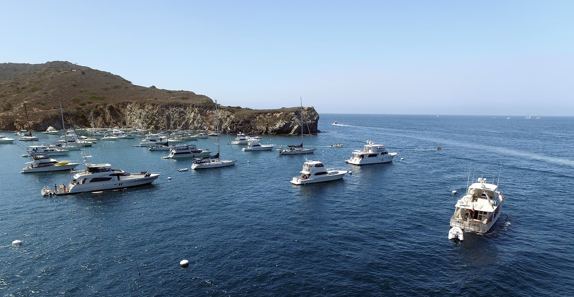
Trans-Catalina hike highlights

  1. 38.5 miles over 3-5 days with approximately 8,500 feet of elevation gain
  2. Five designated campgrounds (reservation required, which serves as permit)
  3. Wildlife encounters: American bison, endemic Catalina Island foxes, and rattlesnakes
  4. Exposed terrain with minimal shade: carry ample water
  5. No running water at Parsons Landing: must reserve locker with water
  6. Ferry logistics to reach and exit the island

How hard the Trans-Catalina hike is

  • Physical DemandFitness and endurance required4/5
  • Technical SkillClimbing, scrambling, or specialized skills1/5
  • Exposure RiskSteep dropoffs and fall potential2/5
  • NavigationRoute finding and trail clarity1/5
  • CommitmentDifficulty of bailing out mid-route3/5

Best for: Fit hikers comfortable with significant daily elevation change and exposed conditions. Good for those seeking a multi-day adventure accessible from Los Angeles.

Recommended experience: Prior backpacking experience recommended. Should be comfortable hiking 10+ miles per day with a full pack.

Not recommended for: Those uncomfortable with heat/sun exposure or who require reliable water sources.

Trailhead information

Avalon Harbor

Primary
0

Starting point for most TCT hikers. Accessible via Catalina Express or Catalina Flyer ferries.

  • Restrooms
  • Water on site

Parking

Leave your car on the mainland. Ferry terminals in San Pedro, Long Beach, and Dana Point have parking.

Getting There

Take Catalina Express from San Pedro (1 hour) or Long Beach (1 hour), or Catalina Flyer from Dana Point (1.25 hours).

Nearest Services

Avalon has restaurants, gear shops, groceries, and camping supplies.

Trailhead information

Two Harbors

Alternate
0

Western village with ferry service. Common exit point or resupply stop.

  • Restrooms
  • Water on site
  • Weak Signal

Parking

N/A: accessible by ferry from San Pedro only.

Getting There

Take Catalina Express from San Pedro to Two Harbors directly, or take shore boat from Avalon.

Nearest Services

Small general store, restaurant, and camping supplies.

When to hike Trans-Catalina

Best time to visit

Spring (March-May) and fall (September-November) offer the best conditions. Summer can be extremely hot and dry. Winter is possible but may have rain and rough ferry crossings.

Weather Forecast

Trailhead (0 ft)

Today

🌫️

81°

64°

Wed

🌫️

80°

65°

Thu

🌧️

72°

64°

Fri

☀️

73°

70°

Sat

☀️

76°

72°

Sun

☀️

77°

73°

Mon

☀️

78°

73°

View full NWS forecast →Mountain weather changes rapidly. This forecast is a guide—always be prepared for worse conditions.

Trans-Catalina photography guide

Golden Hour

Sunset from Little Harbor Beach is spectacular: the sun drops into the Pacific directly west. Two Harbors isthmus at sunrise shows both harbors simultaneously.

Best Light

Late afternoon light illuminates the mainland skyline from the ridgeline sections. Bison are most active in early morning and late afternoon.

Beat the Crowds

Weekdays in spring and fall are quietest. Little Harbor fills quickly on weekends. Arrive early to claim a good spot.

Classic Shots

  1. Bison herd with Pacific Ocean backdrop
  2. Little Harbor crescent beach from the trail above
  3. Two Harbors isthmus showing both harbors
  4. Sunset at Parsons Landing
  5. Catalina foxes along the trail
  6. View of the mainland from Airport in the Sky

Trans-Catalina rules, gear and safety

Gear checklist

Required
  • Minimum 3 liters water capacity (limited refill points)
  • Sun protection (exposed terrain with little shade)
  • Sturdy footwear for rocky, steep trail sections
  • Ferry ticket reservations (book well in advance for peak times)
  • Campground reservations (book January 1 for entire year)

Recommended gear

  • Trekking poles for steep descents
  • Wide-brimmed hat and lightweight long sleeves
  • Cash for Airport in the Sky food and Two Harbors store
  • Binoculars for wildlife viewing
  • Swimsuit for beach campgrounds

Rules & regulations

  1. 01Campground reservations required (serve as hiking permit)
  2. 02Dispersed camping prohibited: must stay in designated campgrounds
  3. 03Dogs allowed on trail but prohibited at Hermit Gulch and Two Harbors campgrounds
  4. 04Campfires only allowed in provided fire pits
  5. 05Stay on designated trails: much of the island is private conservancy land
  6. 06Pack out all trash

Hazards & considerations

  • Heat and sun exposure: trail is mostly shadeless
  • Rattlesnakes: common throughout the island
  • Bison: keep 25+ foot distance; they can be aggressive
  • Steep terrain with loose footing on descents
  • Limited escape routes: injury evacuation can be challenging

Safety & planning

Emergency Info

Emergency contacts, ranger station locations, and satellite communicator tips for Trans-Catalina.

Food Storage

Bear canister requirements, approved container lists, and rental locations for this permit.

Gear Checklist: Required and recommended gear for Trans-Catalina · Shuttle Services: Trailhead transportation options · Guide Services: Experienced wilderness guides

Some links may be affiliate links. Purchases support PermitSnag at no extra cost to you.

Trans-Catalina FAQ

How do I get a Trans-Catalina permit?

Trans-Catalina is issued directly by the agency. Book the Trans-Catalina Trail one campground a night: the Catalina Island Company's booking page puts each night's campground in one cart. We check all five: Hermit Gulch, Blackjack, Little Harbor, Two Harbors and Parsons Landing. Set an alert on the nights you need, then book each one on their camping page. Bring backup dates and check their page for the current process.

When is the best time to visit Trans-Catalina?

Season dates are on the agency's page. Weekdays have better availability than weekends.

How competitive is the Trans-Catalina permit?

This permit has a demand score of 8/10, making it highly competitive. We recommend having backup dates and reading the official permit page for how this one is issued.

What if I can't get a Trans-Catalina permit?

The agency awards this permit directly. Bring backup dates and check the official page for the current process and any closures.

Alternatives to a Trans-Catalina permit

  • Easier AlternativePermit required

    Avalon to Two Harbors via Trans-Catalina

    Hike from Avalon to Two Harbors (26 miles) and take the ferry back, skipping the remote Parsons Landing section.

    Tradeoffs

    Shorter commitment, easier logistics, but misses the most primitive camping experience.

  • Easier AlternativePermit required

    Little Harbor Out-and-Back

    Day hike or overnight to Little Harbor from either Avalon or Two Harbors.

    Tradeoffs

    Access to the trail's most scenic beach camp without the full traverse commitment.

  • Same AreaPermit required

    Channel Islands National Park

    Backpacking on Santa Cruz, Santa Rosa, or San Miguel Islands in the national park.

    Tradeoffs

    More remote and wild, but requires boat reservations through Island Packers and is less accessible.

Plan the full trip, not just the permit

Build your full itinerary start to finish

Add your dates and get a day-by-day plan: what needs a permit, what gear to bring, and one link to share with your whole group to coordinate every step.

Plan a trip here

No permit needed to start

One tick helps us more than you’d think

Google lets you pick the sites it highlights for you. Add PermitSnag and our permit pages get marked as one of yours in AI Overviews and AI Mode.

Add PermitSnag in Google

Takes less than a minute.