Lottery6/10
Coyote Buttes South
Equally stunning but easier to get than The Wave....
View Coyote Buttes South Permit permit details and availabilityPermitSnag checks Recreation.gov every 2-3 minutes. When a cancellation posts, we send an alert so you can book before the spot is gone.

Vermilion Cliffs National Monument
The legendary sandstone formation—one of the most photographed geological wonders on Earth. Only 64 people per day allowed.
“Stand in the flowing lines of 190-million-year-old sandstone—a geological masterpiece formed when dinosaurs roamed the earth.”
Applications are open now. The Wave runs a new lottery every month for dates about four months out. Get reminders for the deadline and results, and apply with a pool to boost your odds.
Applications are open now. The Wave runs a new lottery every month for dates about four months out. Get reminders for the deadline and results, and apply with a pool to boost your odds.
Two ways to land it
We remind you when the The Wave lottery opens, before the deadline, and when results post, so you never miss your window. (This permit runs a lottery only. Leftovers roll into the next lottery, so there are no cancellations to catch.)
Set lottery remindersApply with a crew. Each person multiplies your combined odds (solo ~2-12% by season). We coordinate invites, deadlines, and outcomes.
See plans to start a poolBest odds: run a pool and let us remind you before every deadline.
Better odds with a crew
The Wave is a lottery — solo odds run about 12%. Every friend who applies adds another entry. Five of you, each applying: about 47%.
One of you runs the pool (Pro or a $12 alert). Everyone else joins free.
Spring (March-May) and fall (September-November) offer ideal temperatures. Summer is dangerously hot. Winter is possible but cold and may have snow on the route.
Sign up at Recreation.gov if you don't have an account. Verify your email and add payment info ahead of time.
Submit your application between 4 months ahead. Apply for multiple dates to increase your odds.
Permits get cancelled daily. Peak cancellation times are 24-48 hours before the trip date.
Get instant notifications when cancellations happen. We check availability every 2-3 minutes, 24/7.
Mild temperatures. Occasional rain. Wildflowers in lower elevations.
Fitness and endurance required
Climbing, scrambling, or specialized skills
Steep dropoffs and fall potential
Route finding and trail clarity
Difficulty of bailing out mid-route
Anyone in reasonable physical condition who is comfortable with off-trail navigation in remote wilderness.
GPS navigation experience strongly recommended. Desert hiking experience helpful but not required.
Those uncomfortable with navigation or unable to use GPS. Not suitable for those who cannot handle desert heat.
The Wave is a sandstone rock formation located in the Paria Canyon-Vermilion Cliffs Wilderness near the Arizona-Utah border. Formed from 190-million-year-old Jurassic-age Navajo sandstone, the formation is famous for its colorful, flowing, striped bands of rock.
Due to the fragility of the formation and the surrounding ecosystem, access is strictly limited to 64 people per day (or 16 groups of up to 4). Permits are required year-round and are distributed via two lottery systems—an advance lottery four months ahead and a daily lottery two days before.
The Wave is one of the planet's most remarkable examples of cross-bedded sandstone—ancient sand dunes turned to stone, then carved by wind and water into sinuous, flowing lines. Discovered by hikers in the 1990s, it has become the holy grail of landscape photography and a pilgrimage site for geology enthusiasts worldwide.
From Wire Pass Trailhead, the route follows a wash for about a mile before climbing onto slickrock. There is no marked trail—navigation relies on photo waypoints provided by the BLM and GPS coordinates. Twin Buttes serve as the primary landmark.
The terrain shifts from sandy wash to deep sand dunes to sculpted slickrock. The Wave itself sits in a bowl between rock formations, invisible until you're nearly upon it. Two main chutes compose the classic 'Wave' formation, but the surrounding 1,600 acres of Coyote Buttes North contain dozens of additional features worth exploring: The Second Wave, The Boneyard, Top Rock Arch, and prehistoric dinosaur tracks.
Nothing prepares you for the moment you crest the rise and The Wave appears. It's not just a formation—it's a portal to deep time. The flowing bands of red, orange, and cream were ancient sand dunes 190 million years ago. Now they ripple like frozen waves, drawing your eye along curves that seem impossible in stone. You'll spend hours exploring every alcove and chute, watching the light shift and reveal new details.
The only authorized access point for Coyote Buttes North and The Wave. Located on House Rock Valley Road.
Small dirt parking area. High-clearance vehicle recommended for House Rock Valley Road, though passenger cars can make it in dry conditions.
From US 89A, turn south onto House Rock Valley Road and drive 8.3 miles to the trailhead. Road is dirt and can be impassable when wet.
Kanab, UT (40 miles) or Marble Canyon, AZ (27 miles). No services at trailhead—bring all water and food.
Required and recommended gear for The Wave
Trailhead transportation options
Browse all shuttlesExperienced wilderness guides
Browse all guidesSome links may be affiliate links. Purchases support PermitSnag at no extra cost to you.
2-12% by season
estimated success rate
Get detailed lottery statistics and tips. Sign up to track this permit.
Apply with a crew to multiply your combined odds, and let auto win-detection tell you the moment you win — you never have to check Recreation.gov. Pool and auto win-detection are on Pro or a $12 permit alert.
Apply these for the best odds
Opens the official lottery — you submit your entry. We never automate or store your Recreation.gov login.
Full lottery odds & strategy →12,453 permits and 8,294 campsites secured by PermitSnag users
The Wave permits use a lottery system. The lottery typically opens 4 months ahead. PermitSnag sends lottery open, deadline, and results reminders.
The season typically runs Year-round. Weekdays generally have better availability than weekends.
This permit has a demand score of 10/10, making it extremely competitive. We recommend having backup dates and applying with a pool to boost your odds.
This permit is awarded by lottery, so there's no cancellation inventory to track. PermitSnag reminds you when the next lottery opens, before the deadline, and when results post — and you can apply with a pool to boost your odds.
The Wave's chutes are best photographed at midday when the sun is directly overhead, minimizing shadows in the narrow formations.
Midday (10am-2pm) provides the most even light in The Wave itself. The Second Wave is best in late afternoon when low sun brings out deep orange hues.
With only 64 people per day, The Wave is never truly crowded. Arrive early to have the formation to yourself before other permit holders arrive.
Consider these alternatives if your preferred dates aren't available.
Similar sandstone formations with better lottery odds. Features include The Cotton Candy, Paw Hole, and Teepees.
Much easier to get a permit (same lottery system but less demand). Formations are spectacular but lack the iconic Wave shape.
Spectacular brain-rock formations without permit requirement. Located 20 miles south of The Wave.
No permit needed but requires high-clearance 4WD and navigation skills. Road can be impassable when wet.
The world's longest slot canyon, starting from the same Wire Pass Trailhead.
Different type of experience (slot canyon vs. surface formations) but uses same access point.
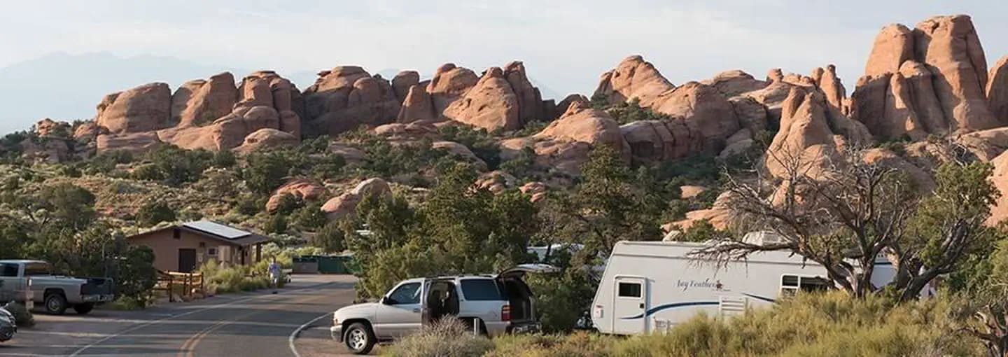
Nearby campgrounds to complete your The Wave trip
Permit Directory
Find permits for day hikes, overnight backpacking, thru-hikes, canyoneering, and river trips across federal and state lands.
Day-use, overnight, and wilderness permits at America's crown jewels
Sierra Nevada, Lost Coast, and backcountry access
Red rock canyons, slot canyon permits, and desert wilderness
USFS wilderness areas with quota systems
Multi-day point-to-point traverses and epic long-distance trails
Multi-day rafting and river access permits
Backcountry camping and trail permits
High-altitude summit permits and technical climbing routes