Skip to content
Highline Trail Permit permit area in Glacier National Park - backcountry hiking destination
Booked one camp per night, in order

Highline Trail Permit

Glacier National Park · Montana

Walk the knife-edge of the Continental Divide along Glacier's famous Garden Wall, where mountain goats traverse cliff faces and wildflower meadows stretch to the horizon.

Get an alert when a night opens on your Highline Trail dates.

Get alerts for your Highline Trail nights

A Highline Trail reservation is a sequence of nights, and each night books a camp.

Give us your trip window and we check every night of it across all camps on this permit, then tell you the moment nights open.

Cover the whole trip, plus any spare days you could shift onto. A wider window catches more openings.

The window above is how much time you have to work with. This is how many nights the trip itself takes. Leave it blank and we'll check every night in the window. We alert you when 2 or more nights in a row open.

Party

70% of the openings our scanner caught on Highline Trail were gone within 10 minutes.

Highline Trail reservation dates

route distance, point to point
11.8mi
elevation gain
2,388ft
max group size
12people

Highline Trail elevation profile

Logan Pass to The Loop

4,733 ft of descent · 3.8% average grade

Trailhead

Logan Pass

Starting point at 6,646 ft. Visitor center with restrooms. Parking fills early.

Mile 0 of 11.8
0 Logan Pass11.8 The Loop
Mile
0
Elevation
6,646 ft

Highline Trail landmarks

How to get a Highline Trail permit

As of September 2026, Highline Trail in Glacier National Park, Montana requires a permit issued via reservation. Highline Trail is a high-demand permit, rating 8/10 on PermitSnag's demand index. Cancelled Highline Trail permits are re-released on the booking system, and PermitSnag alerts you the moment one opens. The Highline Trail route covers 11.8 miles with 2,388 feet of elevation gain, rated moderate.

Type
Thru-Hike
Location
Northern Rockies, MT
  1. Step 1: Create a National Park Service account

    Sign up at National Park Service if you don't have an account. Have your payment info ready.

  2. Step 2: Know the release schedule

    Permits release on a rolling basis. Check the release time for your dates.

  3. Step 3: Be ready when permits drop

    Log in a few minutes early. Have your dates, group size, and payment ready to go.

  4. Step 4: Monitor for cancellations

    If your dates are sold out, people cancel all the time. Set up PermitSnag alerts to catch openings instantly.

More on Highline Trail: Live availability activityWhen Highline Trail permits open upDo I need a Highline Trail permit?

How much a Highline Trail permit costs

Highline Trail permit fee: $7/person/night for backcountry camping.

The Highline Trail hike

Distance
11.8 miles
Elevation Gain
2,388 ft
Route Type
Point to Point
Duration
1 day or overnight
Difficulty
Moderate
Elevation Range
4,200 - 7,280 ft

Traverse the spine of the Northern Rockies along a narrow ledge carved into the Garden Wall, where grizzlies roam below and mountain goats scramble above.

About this permit

The Highline Trail is an 11.8-mile point-to-point hike along the Continental Divide in Glacier National Park. Starting at Logan Pass, the trail traverses the famous Garden Wall to Granite Park Chalet, then descends to The Loop on Going-to-the-Sun Road.

While the hike can be done as a long day trip, backpackers can stay at Granite Park Chalet (historic accommodation, reservation required) or designated backcountry campsites with proper permits.

The route

From Logan Pass, the trail immediately enters its most notorious section: a narrow ledge carved into the cliff face of the Garden Wall. A steel cable provides psychological comfort more than safety. After 0.3 miles, the trail widens and the exposure eases.

For the next seven miles, the trail traverses along the Continental Divide, gaining and losing elevation gradually through alpine meadows and along cliff faces. Haystack Pass offers panoramic views of glacial valleys carved during the Pleistocene.

Near Granite Park Chalet, an optional spur trail climbs steeply to the Grinnell Glacier Overlook (1,000 feet in 0.8 miles), offering a bird's-eye view of the rapidly retreating glacier. The chalet itself is a historic landmark, though it has no running water and requires advance reservations for overnight stays.

The descent via Loop Trail drops 3,000 feet in 4 miles through switchbacks to The Loop parking area, where a free shuttle returns hikers to Logan Pass.

Why it matters

The Highline Trail is Glacier National Park's signature hike, a high-altitude traverse that follows the Continental Divide through some of the most dramatic scenery in the American West. The trail passes through the heart of what John Muir called 'the best care-killing scenery on the continent.' It's the quintessential Glacier experience.

The feeling

The trail begins with a thrill: the narrow ledge section with a steel cable bolted into the cliff face, hundreds of feet of exposure below. Then the anxiety fades into wonder. For seven miles, you walk the spine of the continent, the Garden Wall rising above, glacial valleys plunging below on both sides. Mountain goats appear on impossible ledges. Wildflowers carpet every meadow. And in the distance, peak after snow-capped peak stretches to the horizon.
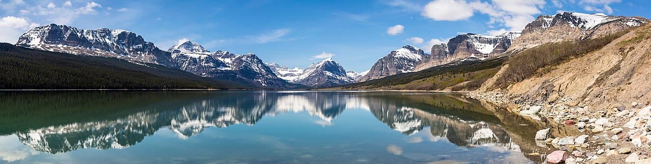
Highline Trail hike highlights

  1. 11.8 miles point-to-point with 2,388 ft of gain and 4,773 ft of loss, per the park
  2. Initial narrow ledge section with steel cable (exposure)
  3. High-altitude traversing along the Continental Divide
  4. World-class wildflower displays in late July
  5. Active grizzly bear habitat: carry bear spray
  6. Shuttle required to return to starting point

How hard the Highline Trail hike is

  • Physical DemandFitness and endurance required3/5
  • Technical SkillClimbing, scrambling, or specialized skills2/5
  • Exposure RiskSteep dropoffs and fall potential3/5
  • NavigationRoute finding and trail clarity1/5
  • CommitmentDifficulty of bailing out mid-route3/5

Best for: Fit hikers comfortable with moderate distance and some exposure. The cable section requires a head for heights.

Recommended experience: Prior hiking experience at elevation helpful. No technical skills required.

Not recommended for: Those with severe fear of heights or uncomfortable with wildlife encounters (grizzlies are common).

Trailhead information

Logan Pass

Primary

6,647 ft elevation

Starting point on Going-to-the-Sun Road. Visitor center with exhibits and restrooms.

  • Restrooms
  • Water on site
  • Weak Signal

Parking

Popular lot fills by 7:30-8:00am in peak season. Timed entry may be required. Free shuttle available.

Getting There

Located at the summit of Going-to-the-Sun Road. Road opens late June to mid-October, weather dependent.

Nearest Services

West Glacier (33 miles) or St. Mary (18 miles) for full services.

Trailhead information

The Loop

Alternate

4,200 ft elevation

Common exit point. Small parking area on Going-to-the-Sun Road.

  • No restrooms
  • No water
  • No Service

Parking

Very small lot (~20 cars). Fills extremely early. Better to shuttle.

Getting There

Located on Going-to-the-Sun Road, 4 miles west of Logan Pass.

Nearest Services

Lake McDonald Lodge (5 miles).

When to hike Highline Trail

Best time to visit

Late July through mid-September. Trail typically opens when Going-to-the-Sun Road opens (late June). Late July has peak wildflowers. September offers fewer crowds and golden larches.

Weather Forecast

Trailhead (4,200 ft)

⚠️

Backcountry Tips

  • Today: Rain below, snow at elevation. Microspikes may be needed.
  • Today: 100% chance of precipitation. Pack rain gear.
  • Tomorrow: Freezing temps at elevation. Bring insulation even if warm below.

Today

🌧️

35°

32°

100%

Wed

❄️

39°

33°

99%

Thu

❄️

38°

29°

99%

Fri

❄️

37°

32°

85%

Sat

🌧️

38°

31°

94%

Sun

🌧️

37°

33°

100%

Mon

🌧️

38°

34°

84%

View full NWS forecast →Mountain weather changes rapidly. This forecast is a guide—always be prepared for worse conditions.

Highline Trail photography guide

Golden Hour

Morning light on the Garden Wall from the trail is spectacular. The Grinnell Glacier Overlook offers dramatic shots of the glacier at any time.

Best Light

East-facing shots are best in morning; west-facing in late afternoon. Wildflowers peak in late July.

Beat the Crowds

Start before 8am to beat the crowds and secure parking at Logan Pass. Weekdays are significantly less crowded than weekends.

Classic Shots

  1. Garden Wall cliffs from the narrow ledge section
  2. Mountain goats on cliff faces (common near the cable section)
  3. Grinnell Glacier from the overlook
  4. Wildflower meadows with Heaven's Peak in background
  5. Granite Park Chalet with surrounding peaks

Highline Trail rules, gear and safety

Gear checklist

Required
  • Bear spray (readily accessible: this is prime grizzly habitat)
  • Minimum 2 liters water (no sources between Logan Pass and The Loop)
  • Rain gear (weather changes rapidly)
  • Layers for temperature variations

Recommended gear

  • Trekking poles (essential for the steep descent to The Loop)
  • Binoculars for wildlife viewing
  • Camera with telephoto for mountain goats
  • Sun protection (exposed trail)

Rules & regulations

  1. 01Backcountry permit required for overnight camping
  2. 02Granite Park Chalet reservations required for overnight stays
  3. 03Dogs strictly prohibited on trail
  4. 04No bicycles or horses
  5. 05Timed entry reservation may be required for Going-to-the-Sun Road
  6. 06Each wilderness campsite holds a maximum of 4 campers, so a party of 5-8 needs 2 sites and 9-12 needs 3
  7. 07Backcountry advance reservations cover groups up to 8; 9-12 campers only through the March 1 large group lottery (Glacier issues five of those per year park-wide) or a walk-up permit

Hazards & considerations

  • Grizzly bears: make noise, carry bear spray, know how to use it
  • Exposure on cable section: not recommended for those afraid of heights
  • No water on trail: carry all you need
  • Weather changes rapidly: hypothermia possible even in summer
  • Snow may linger on trail into July

Safety & planning

Emergency Info

Emergency contacts, ranger station locations, and satellite communicator tips for Highline Trail.

Food Storage

Bear canister requirements, approved container lists, and rental locations for this permit.

Gear Checklist: Required and recommended gear for Highline Trail · Shuttle Services: Trailhead transportation options · Guide Services: Experienced wilderness guides

Some links may be affiliate links. Purchases support PermitSnag at no extra cost to you.

Highline Trail FAQ

How do I get a Highline Trail permit?

PermitSnag alerts you the moment a Highline Trail cancellation opens, so you can book it before anyone else. Highline Trail permits use a reservation system.

When is the best time to visit Highline Trail?

Season dates are on the agency's page. Weekdays have better availability than weekends.

How competitive is the Highline Trail permit?

This permit has a demand score of 8/10, making it highly competitive. We recommend having backup dates and using PermitSnag's cancellation alerts.

What if I can't get a Highline Trail permit?

Cancellations happen daily. Set up alerts with PermitSnag to get notified the moment a spot opens up. Pro and $19 single-permit alerts are checked about every minute, 24/7; free accounts are checked hourly.

Alternatives to a Highline Trail permit

  • Similar ExperiencePermit required

    Glacier National Park Wilderness Permit

    The whole-park backcountry permit that covers every ranger district, if you want to build a multi-night route instead of the Highline day.

    Tradeoffs

    Advance reservations open in a March request period and sell out fast, so cancellation alerts matter.

  • Easier AlternativeNo permit needed

    Highline Out-and-Back to Haystack

    Hike to Haystack Pass and return to Logan Pass (7.2 miles round trip). No shuttle needed.

    Tradeoffs

    Misses Granite Park Chalet and the dramatic descent, but captures the Garden Wall scenery.

  • Same AreaNo permit needed

    Grinnell Glacier Trail

    Day hike to Grinnell Glacier from Many Glacier (11.2 miles round trip). Direct glacier access.

    Tradeoffs

    Different experience: approaches the glacier from below rather than above.

  • Similar ExperiencePermit required

    Northern Circle (Highline Extension)

    Continue from Granite Park Chalet to Many Glacier via Swiftcurrent Pass for a multi-day traverse.

    Tradeoffs

    Requires backcountry permits and more time, but offers more extensive wilderness experience.

Plan the full trip, not just the permit

Build your full itinerary start to finish

Add your dates and get a day-by-day plan: what needs a permit, what gear to bring, and one link to share with your whole group to coordinate every step.

Plan a trip here

No permit needed to start

One tick helps us more than you’d think

Google lets you pick the sites it highlights for you. Add PermitSnag and our permit pages get marked as one of yours in AI Overviews and AI Mode.

Add PermitSnag in Google

Takes less than a minute.