Lottery10/10
Mt. Whitney Day
Climb the highest peak in the contiguous United States (14,505 ft). The main Whi...
View Mount Whitney Day Hike Permit permit details and availabilityPermitSnag checks Recreation.gov every 2-3 minutes. When a cancellation posts, we send an alert so you can book before the spot is gone.

Sequoia & Kings Canyon National Parks
A legendary 72-mile trans-Sierra traverse from the giant sequoias to the summit of Mount Whitney—America's highest peak in the Lower 48.
“Walk from the world's largest trees to the highest peak in the contiguous United States—a 72-mile journey across the spine of the Sierra Nevada.”
Be notified instantly when High Sierra Trail permits become available due to cancellations.
Be notified instantly when High Sierra Trail permits become available due to cancellations.
Mid-July through September. July may have lingering snow on Whitney's switchbacks. August has the most stable weather but also the most crowded Whitney Zone. September offers solitude and golden light but shorter days.
Sign up at Recreation.gov if you don't have an account. Have your payment info ready.
Permits typically release on a rolling basis. Check the specific release time for your desired dates.
Log in a few minutes early. Have your dates, group size, and payment ready to go.
If your dates are sold out, people cancel all the time. Set up PermitSnag alerts to catch openings instantly.
Snow-free above 10,000 ft by mid-July most years. Afternoon thunderstorms common.
Fitness and endurance required
Climbing, scrambling, or specialized skills
Steep dropoffs and fall potential
Route finding and trail clarity
Difficulty of bailing out mid-route
Experienced backpackers comfortable with week-long wilderness expeditions and high-altitude travel.
Should have completed at least one multi-day trip of 40+ miles and have experience hiking at elevations above 12,000 feet.
First-time backpackers or those without prior high-altitude experience.
The High Sierra Trail is a 72-mile point-to-point traverse of Sequoia National Park, connecting Crescent Meadow in the west to Mount Whitney's summit in the east. The trail crosses the Great Western Divide at Kaweah Gap, descends into the remote Kern River canyon, and joins the John Muir Trail for the final climb to Whitney.
Most hikers complete the HST in 6-8 days, with the permit including Whitney summit access when exiting via Whitney Portal. The route accumulates approximately 15,500 feet of elevation gain and 13,900 feet of loss.
The High Sierra Trail is California's premier west-to-east trans-Sierra route, offering a complete cross-section of the range's geology and ecology. Unlike the north-south JMT, the HST traverses perpendicular to the Sierra's grain, crossing the Great Western Divide before joining the JMT for the climactic ascent of Mount Whitney. For many hikers, the HST represents the ultimate Sierra experience—from sequoia groves to alpine granite.
The HST begins gently among giant sequoias at Crescent Meadow (7,030 ft). The first miles traverse the western slopes with increasingly dramatic views into the Middle Fork Kaweah canyon. At mile 11, Bearpaw Meadow offers the only High Sierra Camp along the route—a rustic resupply option with tent cabins and hot meals.
Hamilton Lake appears at mile 17—a stunning cirque lake that many consider the trail's most beautiful single feature. Beyond, the trail climbs to Precipice Lake and crosses Kaweah Gap (10,700 ft), the passage through the Great Western Divide.
The descent into Big Arroyo brings you to the Kern River canyon—the Sierra's deepest and most remote. At mile 30, Kern Hot Springs offers a natural soak beside the rushing river. The route follows the Kern north to its junction with the JMT at Wallace Creek.
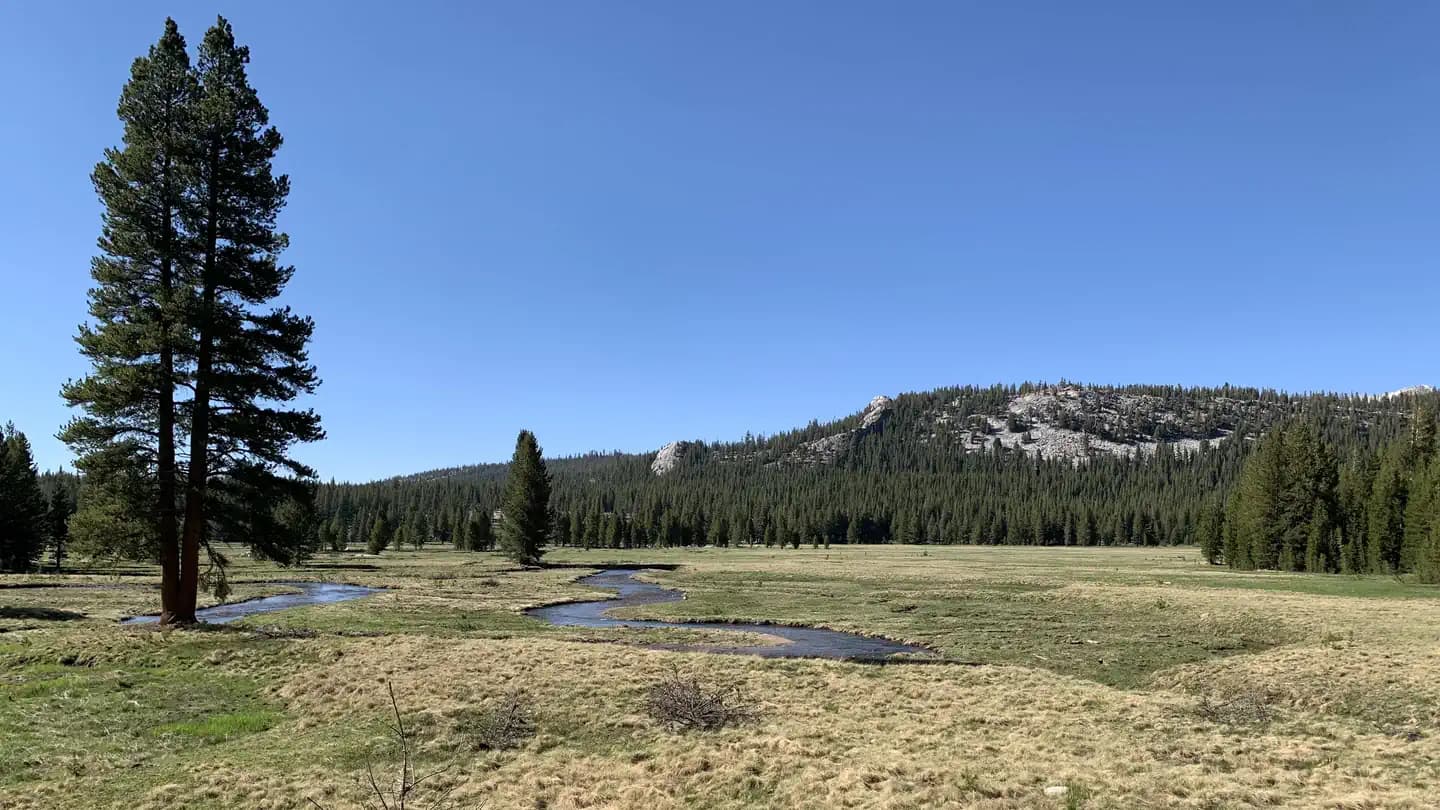
The final push covers 18 miles of the JMT's finest terrain: from Wallace Creek over Bighorn Plateau, past Guitar Lake (the final camp at 11,500 ft), and up the famous 99 Switchbacks to Trail Crest. Two final miles of ridge walking deliver you to Whitney's summit at 14,505 feet, the highest point in the Lower 48.
You begin in the shadow of giants—the General Sherman Tree, the largest living thing on Earth, stands nearby as you set off from Crescent Meadow. A week later, you'll be standing on Mount Whitney's summit, the entire Sierra Nevada spread below you in every direction. Between lies a journey that feels almost mythical: the deep azure of Hamilton Lake, the steaming miracle of Kern Hot Springs, the lonely expanse of the Kern Trench, and finally, Guitar Lake's treeless basin beneath the soaring pyramid of Whitney itself.
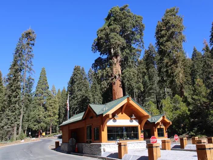
Western terminus of the HST in Sequoia National Park's Giant Forest area.
Paved lot at Crescent Meadow fills early on summer weekends. Overflow parking at Giant Forest Museum.
From Three Rivers, enter Sequoia via the Ash Mountain entrance. Follow Generals Highway to Giant Forest, then Crescent Meadow Road.
Lodgepole Village (5 miles) has store, showers, and restaurant. Three Rivers (25 miles) has full services.
Eastern terminus of the HST. Permit includes exit via Whitney Trail—no additional Whitney permit needed.
Overnight parking limited. Arrange pickup or use shuttle to Lone Pine.
Whitney Portal is 13 miles west of Lone Pine on Whitney Portal Road. The two trailheads are approximately 5 hours apart by car.
Whitney Portal Store (seasonal). Lone Pine has full services including motels and restaurants.
Required and recommended gear for High Sierra Trail
Trailhead transportation options
Browse all shuttlesExperienced wilderness guides
Browse all guidesSome links may be affiliate links. Purchases support PermitSnag at no extra cost to you.
12,453 permits and 8,294 campsites secured by PermitSnag users
High Sierra Trail permits use a reservation system. PermitSnag sends lottery open, deadline, and results reminders; you can also enable cancellation alerts if spots open later.
Check with the managing agency for current season dates. Weekdays generally have better availability than weekends.
This permit has a demand score of 8/10, making it highly competitive. We recommend having backup dates and using PermitSnag's cancellation alerts.
Cancellations happen daily. Set up alerts with PermitSnag to get notified the moment a spot opens up. We check availability every 2-3 minutes, 24/7.
Sunrise from the Whitney summit is extraordinary—the shadow of the peak stretches across the Owens Valley. Hamilton Lake at sunset with light hitting the surrounding cliffs is the trail's other signature shot.
Early morning at Hamilton Lake provides mirror reflections. The granite around Precipice Lake glows in late afternoon light.
The HST is far less crowded than the JMT until the trails merge. Early season (late June-early July) and late September offer more solitude.
Consider these alternatives if your preferred dates aren't available.
Hike to Kern Hot Springs and return via the same route, experiencing the hot springs without committing to the full traverse.
Approximately 60 miles round trip. Misses Whitney but includes the hot springs highlight.
Take the HST to Big Arroyo, then exit via Mineral King rather than continuing to Whitney.
Shorter route that misses Whitney but allows a loop with shuttle logistics.
The 211-mile north-south route shares the final 18 miles with the HST including the Whitney summit.
Longer commitment but covers different Sierra terrain. Similar Whitney experience.
Nearby campgrounds to complete your High Sierra Trail trip
Permit Directory
Find permits for day hikes, overnight backpacking, thru-hikes, canyoneering, and river trips across federal and state lands.
Day-use, overnight, and wilderness permits at America's crown jewels
Sierra Nevada, Lost Coast, and backcountry access
Red rock canyons, slot canyon permits, and desert wilderness
USFS wilderness areas with quota systems
Multi-day point-to-point traverses and epic long-distance trails
Multi-day rafting and river access permits
Backcountry camping and trail permits
High-altitude summit permits and technical climbing routes