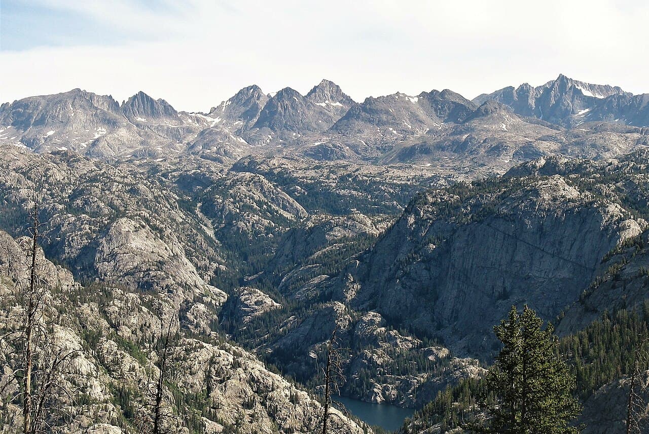
Gannett Peak (Wyoming Highpoint) Permit
Wyoming's highest at 13,804 ft. Technical glacier climb.
“The highest point in Wyoming has no permit, no quota and no ranger, just a very long walk before the mountaineering starts.”
Plan your Bridger-Teton National Forest / Wind River Range trip here, then get your permit from the agency.
Walk-up permit
How to get Gannett Peak
Gannett Peak is issued by the agency rather than through a booking calendar. Their page has the current process and any dates.
Official permit pagePlanning another trip? See the permits we alert on.
How to get a Gannett Peak permit
- Permit required
- No
- Type
- Climbing
- Location
- Wind River Range, Wyoming, WY
How this permit is issued
Get this permit in person at the trailhead or ranger station, or by phone.
Official permit page →Gannett Peak pro tips
- There is no permit for an individual party. Organized groups and overnight stock users need a free Bridger Wilderness permit from the Pinedale Ranger District, applications from April 1
- Gannett sits on the boundary with the Fitzpatrick Wilderness on the Shoshone National Forest. Bridger-Teton warns explicitly that regulations change when you cross the Divide
- Order 04-03-328 caps camping at 14 days in any 30-day period within a five-mile radius, which matters on a trip long enough to include weather days
- Bridger-Teton lists no potable water anywhere in this wilderness
- Pinedale Ranger District: 307-367-4326
More on Gannett Peak: Live availability activity
How much a Gannett Peak permit costs
Gannett Peak permit fee: No fee. Individual climbing and backpacking in the Bridger Wilderness needs no permit.
The Gannett Peak climb
- Route Type
- Out & Back
- Duration
- 4-7 days
- Difficulty
- Expert
The highest point in Wyoming has no permit, no quota and no ranger, just a very long walk before the mountaineering starts.
About this permit
Gannett Peak is the highest point in Wyoming, on the shared boundary between the Bridger Wilderness and the Fitzpatrick Wilderness. Bridger-Teton National Forest runs no quota, no lottery and no fee for climbing it.
The permit rules that do exist are narrow. Bridger-Teton requires free permits for organized group use and overnight stock use in the Bridger Wilderness, with applications accepted beginning April 1 for the current year through the Pinedale Ranger District at 307-367-4326. Forest-wide Order 04-03-328 caps camping at 14 days in any 30-day period within the same five-mile radius.
Everything else about this climb is logistics and weather. Bridger-Teton describes a wilderness of 600 miles of trail running 80 miles along the Continental Divide, with elevations above 13,000 feet and winter never far off. It lists no potable water anywhere in the system.
The route
Gannett sits on the boundary between the Bridger Wilderness on the Bridger-Teton National Forest and the Fitzpatrick Wilderness on the Shoshone National Forest, which means the permit answer depends on which side you approach from and where you cross.
On the Bridger side there is no permit for individuals. Bridger-Teton requires free permits only for organized group use and for overnight stock use, applied for from April 1 each year through the Pinedale Ranger District. Bridger-Teton also warns visitors directly to be aware of changing regulations when they cross the Continental Divide onto the Shoshone National Forest.
Forest Order 04-03-328 applies to the whole trip: no camping within the same five-mile radius for more than 14 days in any 30-day period.
Why it matters
Bridger-Teton National Forest puts it in one sentence: "The highest point in Wyoming, Gannett Peak rests on the shared boundary with Fitzpatrick Wilderness offering mountaineers a great and memorable challenge." It is the state highpoint that cannot be day-hiked, and the approach is the reason.
The feeling
Days of walking through granite and lake country before the peak is even a factor, then glacier and snow to finish. Bridger-Teton describes the range as combining elevation and potential cold to create a truly wild feeling. On Gannett that stops being a description and becomes the itinerary.
Gannett Peak climb highlights
- No permit and no fee for an individual party
- A multi-day approach before any climbing begins. This is not a trailhead-to-summit day
- Glacier and snow travel on the peak itself
- A wilderness boundary crossing, with different regulations on the Shoshone side
- No potable water and no staffed presence of any kind
How hard the Gannett Peak climb is
- Physical DemandFitness and endurance required5/5
- Technical SkillClimbing, scrambling, or specialized skills4/5
- Exposure RiskSteep dropoffs and fall potential4/5
- NavigationRoute finding and trail clarity4/5
- CommitmentDifficulty of bailing out mid-route5/5
Best for: Experienced mountaineers who can manage glacier travel at the end of a multi-day approach with no support.
Recommended experience: Glacier travel, crevasse rescue, and prior multi-day self-supported trips at altitude.
Not recommended for: Highpointers treating this like the other 49. It is the hardest state highpoint outside Alaska and there is nobody out there to notice you are overdue.
When to climb Gannett Peak
Best time to visit
Mid-July through August is the standard window, when the approach is snow-free and the snow on the peak is still consolidated. Bridger-Teton's framing, winter always just a breath away, applies to every week either side of that.
- Peak
- Mid-July through August
- Shoulder
- Early July and early September
Spring
Full snow cover on the approach and the peak.
Crowd level · low
- Advantage: Snow-covered approach can be faster on skis
- Challenge: Avalanche hazard
- Challenge: Road access
- Challenge: Very long days needed
Summer
The climbing season. Approach melts out through July.
Crowd level · moderate
- Advantage: Snow-free approach
- Advantage: Consolidated snow on the route
- Advantage: Longest days
- Challenge: Afternoon storms
- Challenge: Crevasses opening up by late season
- Challenge: Mosquitoes on the approach in July
Fall
Cold, clear and short. The window closes fast.
Crowd level · low
- Advantage: Stable high pressure some years
- Advantage: No bugs
- Challenge: Hard freezes
- Challenge: New snow over old ice
- Challenge: Short days for a long route
Winter
A full expedition.
Crowd level · low
- Advantage: Total solitude
- Challenge: Extreme cold
- Challenge: Unplowed access
- Challenge: Avalanche terrain throughout
Weather Forecast
Trailhead (5,000 ft)
Today
66°
46°
Wed
70°
44°
Thu
71°
43°
Fri
73°
44°
Sat
71°
45°
Sun
75°
45°
Mon
75°
48°
Gannett Peak photography guide
Golden Hour
Alpenglow on the summit block from a high camp, which is the only realistic place to shoot it from.
Best Light
Early morning on the glacier before the sun softens everything.
Beat the Crowds
The approach is the filter. Very few parties get this far, and midweek in August you may see nobody above the last lake.
Classic Shots
- The peak from the approach basin, still a day away
- Glacier ice and crevasse texture
- A high camp with the Divide behind it
- The summit view across the whole Wind River Range
Gannett Peak rules, gear and safety
Gear checklist
Required- Glacier and snow travel equipment appropriate to the route and season
- Water filter or treatment; Bridger-Teton lists no potable water in this wilderness
- Bear-resistant food storage
- Full cold-weather kit: elevations here run above 13,000 feet
- Navigation for a multi-day approach across a 600-mile trail system
Recommended gear
- A satellite messenger, because self-rescue is otherwise the only rescue
- Spare food for a weather day, which is a normal outcome here
- Traction and an axe well into the summer
Rules & regulations
- 01No permit is required for an individual or family backpacking trip. Bridger-Teton National Forest states that permits are required for group use and overnight stock use in the Bridger Wilderness
- 02Group-use and recreational-livestock permits are free, and the Pinedale Ranger District only accepts applications beginning April 1 for the current year
- 03Forest Order 04-03-328 caps camping at 14 days in any 30-day period within the same five-mile radius. After that you have to move outside that radius for 30 days
- 04Standard Wilderness Act rules apply: no motorized or mechanized equipment, including bicycles, carts and drones
Hazards & considerations
- Altitude. The Bridger Wilderness runs above 13,000 feet and the trails spend most of their length high
- Weather that turns over fast. Bridger-Teton describes the combination of elevation and potential cold as creating a truly wild feeling, which is a polite way of saying summer snow happens
- No potable water at the trailheads. Bridger-Teton lists it as unavailable at both the wilderness and at Big Sandy Trailhead, so everything gets filtered
- Long drives on unpaved county and Forest Service roads to reach the trailheads
- Bears. This is the Wind Rivers and food storage matters
- Glacier travel and crevasse hazard on the peak
- A rescue timeline measured in days, not hours, because of the approach
Safety & planning
Emergency Info
Emergency contacts, ranger station locations, and satellite communicator tips for Gannett Peak.
Food Storage
Bear canister requirements, approved container lists, and rental locations for this permit.
Gear Checklist: Required and recommended gear for Gannett Peak · Shuttle Services: Trailhead transportation options · Guide Services: Experienced wilderness guides
Some links may be affiliate links. Purchases support PermitSnag at no extra cost to you.
Gannett Peak FAQ
Do I need a permit to climb Gannett Peak?
Not as an individual or a small private party. Bridger-Teton National Forest requires free permits only for organized group use and overnight stock use in the Bridger Wilderness, applied for from April 1 through the Pinedale Ranger District. There is no quota, no lottery and no climbing fee.
Where is Gannett Peak?
On the shared boundary between the Bridger Wilderness on the Bridger-Teton National Forest and the Fitzpatrick Wilderness on the Shoshone National Forest, in the Wind River Range. Bridger-Teton describes it as the highest point in Wyoming.
How long does it take to climb Gannett Peak?
Longer than any other state highpoint in the Lower 48, because the mountain sits deep inside a wilderness with 600 miles of trail and no road close to it. Plan a multi-day approach, a summit day, and a spare day for weather.
Is there a camping limit in the Bridger Wilderness?
Yes. Bridger-Teton Forest Order 04-03-328 prohibits camping within the same five-mile radius for more than 14 days in any 30-day period, and prohibits returning to that radius within 30 days afterwards. It applies forest-wide and runs to July 1, 2030.
Gannett Peak route conditions and trip reports
Trail Conditions
No active conditions reported
Sign in to report trail conditions.
Questions
No questions yet
Be the first to ask about Gannett Peak.
Trip Reports
Write ReportAlternatives to a Gannett Peak permit
- Easier AlternativeNo permit needed
Titcomb Basin
The same wilderness and much of the same approach country, without the glacier travel and the summit commitment.
Tradeoffs
No state highpoint, and no crevasse rescue kit to carry.
- Similar ExperienceNo permit needed
Cirque of the Towers
The southern Wind Rivers, from Big Sandy Trailhead, with world-class granite and no permit.
Tradeoffs
Technical rock rather than glacier, and considerably more company.
Where to stay near Gannett Peak
- Brush Creek Work Center Barrack campgroundMedicine Bow-Routt NFs & Thunder Basin NG
- Brush Creek Pavilion campgroundMedicine Bow-Routt NFs & Thunder Basin NG
- Ryan Park campgroundMedicine Bow-Routt NFs & Thunder Basin NG
- All Wyoming campgrounds
Plan the full trip, not just the permit
Build your full itinerary start to finish
Add your dates and get a day-by-day plan: what needs a permit, what gear to bring, and one link to share with your whole group to coordinate every step.
No permit needed to start
One tick helps us more than you’d think
Google lets you pick the sites it highlights for you. Add PermitSnag and our permit pages get marked as one of yours in AI Overviews and AI Mode.
Takes less than a minute.